JAMESTOWN – Partly to mostly sunny skies will take us through the next couple of days with temperatures resining below average. However, summer will make stark return to the region by the weekend with more heat and humidity.
Through the afternoon, there will be a good supply of sunshine to go around with temps with the mid to upper 70’s. There is a small, about 20 percent, chance for an isolated rain shower across the Southern Tier today.
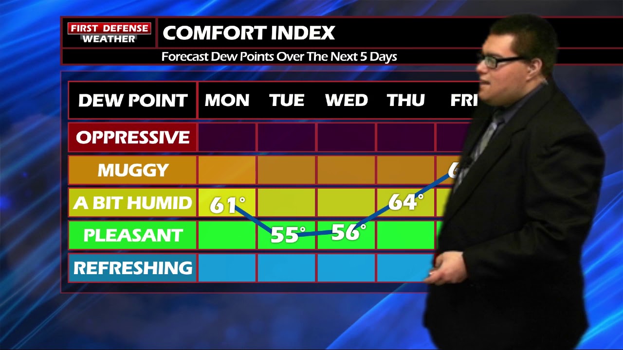
Some patchy fog will setup along the valleys overnight tonight. With clear skies and a light north wind, that will be prime for temperatures to slip back quite a bit by morning. While most everyone will bottom out in the lower to mid 50’s, don’t be surprised if a few spots in the colder pockets around the region dip into the upper 40’s.
Wednesday will be a near carbon-copy of today. Partly to mostly sunny with highs in the upper 70’s and comfortable humidity.
The upper air pattern will begin to shift going into Friday and take on a flow aloft that will favor warmer temperatures and more humidity. Temps will return into the 80’s for the weekend and into early next week with widely-spaced scattered afternoon showers and storms Sunday and Monday.

WNYNewsNow is a proud Ambassador for the NOAA Weather-Ready Nation program.
![]()


Leave a Reply