JAMESTOWN – It maybe a rather dreary and cool day but some some brief recovery is on the way before more widespread showers arrive with a strong frontal system by late week.
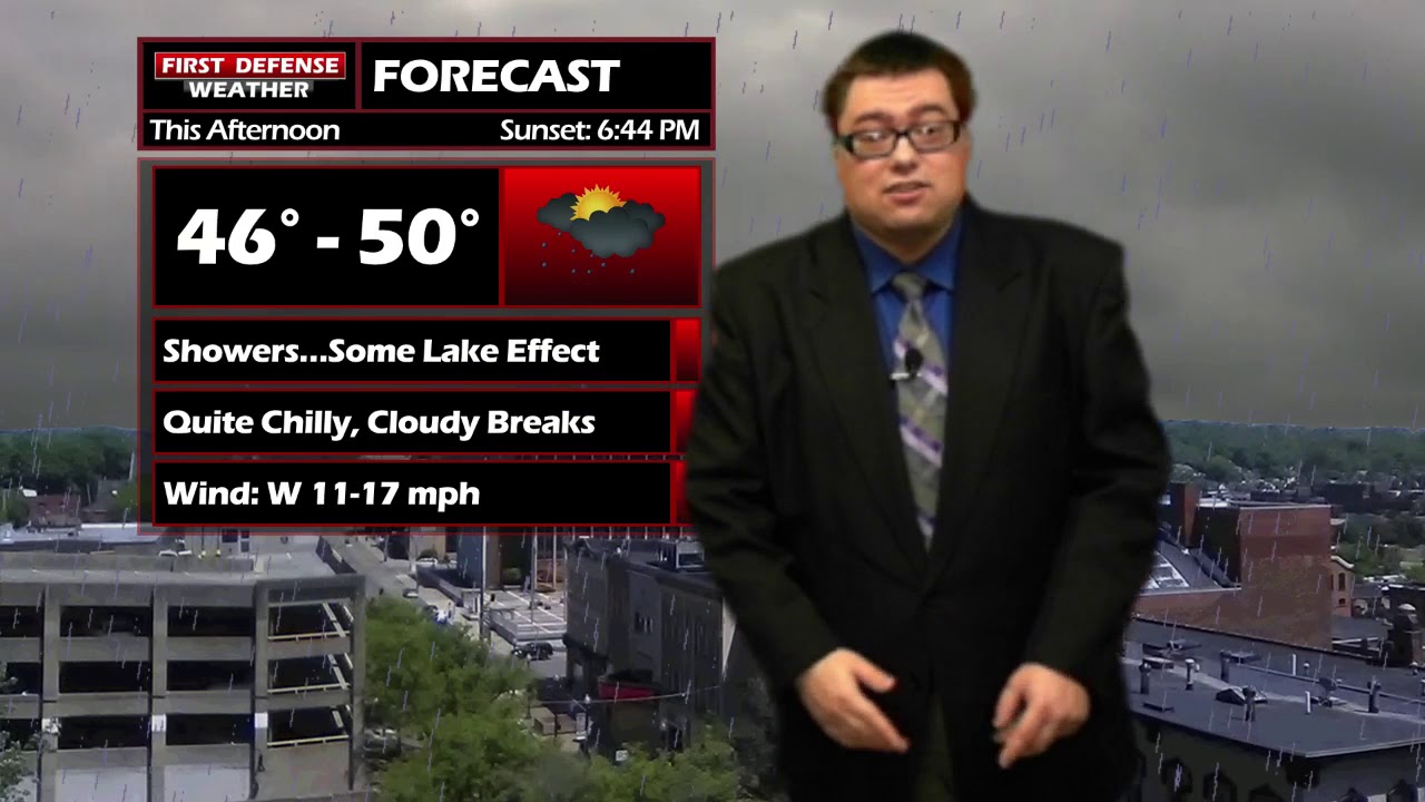
Through the afternoon, on-again, off-again lake effect rain showers will be moving from west to east through Southern Tier. While it will not be raining all day, do not expect much in the way of sunshine. Clouds will pretty much be the story in between the rain coverage. Highs will be held down due to a northerly wind with a progressing Cold front and the cloud cover; 46 to 50.
Any lake effect rain cuts off through the evening hours, leading to mostly cloudy skies for the overnight. Lows 37 to 44.
High pressure builds in on Tuesday, clearing out much of the cloud cover and warming us up nicely into the lower 60’s, which is right around where we should be for this time of the year.
A potent Cold front will sweep through Great Lakes region on Wednesday, bringing more widespread rain to the region. There could be a few rumbles of thunder through the day as well, depending on how much instability we have to work with.
The winds will also increase behind this front later in the day on Wednesday through Thursday. Current guidance indicates some wind gusts could be near Wind Advisory criteria of around 50 MPH.
The front also causes a significant drop in temperature; going back into the mid to upper 40’s on Thursday with lake effect rain showers setting up shop once again.

Partial sunshine returns on Friday and Saturday, becoming mostly sunny on Sunday, with temperatures above average in the upper 60’s.
WNYNewsNow is a proud Ambassador for the NOAA Weather-Ready Nation program.
![]()


Leave a Reply