JAMESTOWN – Tuesday and Wednesday will be fairly uneventful, at least compared to the latter half of the week when a more complex storm system arrives. This system will provide for a blast of winter weather and cooler temperatures, then the 40’s we’ve dealt with the past few days.
This afternoon will be mainly cloudy, with a few afternoon rain showers possible. Temperatures will be in the low 40’s, dropping into the 30’s as the afternoon progresses. Tonight we’ll be mainly cloudy, with a few snow showers possible early. Lows in the mid 20’s.
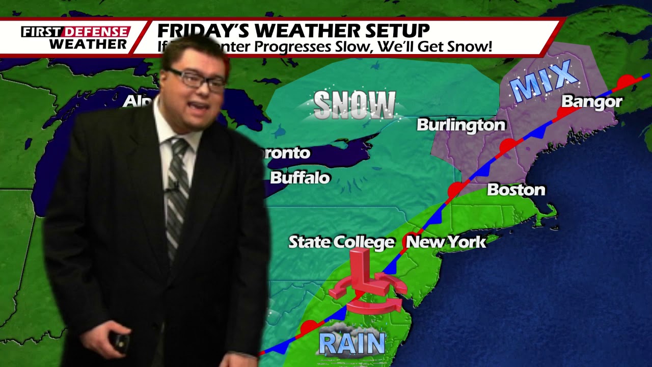
A quiet Wednesday is in store, mostly cloudy with highs in the lower 30’s. A storm system moving into the area late Wednesday and early Thursday will lead to mixed bag of winter weather that is still yet to be determined.

As of now the precipitation will initially start off as snow, with some minor accumulation possible. Warm air will flow into the area in the morning, changing the precipitation over to a mix of sleet and freezing rain, and then eventually to all rain in the afternoon. A messy morning commute is likely. Temperatures on Thursday will be in the upper 30’s to lower 40’s.
As the system moves off into the Atlantic, cold air will be ushered on the back side. This will change the precipitation over to all snow, with Lake enhancment possible. Several inches of snow is likely, especially across the higher terrains. Temperatures on Friday near 30.

High pressure builds in for the weekend that will cut off any leftover lake effect snow showers early on Saturday. Temperatures both weekend days in the lower 30’s.
WNYNewsNow is a proud Ambassador for the NOAA Weather-Ready Nation program.
![]()


Leave a Reply