JAMESTOWN – As we have been discussing throughout much of this week, an impactful storm system will ride along the East Coast tonight through Friday and lead to a slushy accumulation before changing to all snow on Friday.
The National Weather Service has issued a Winter Weather Advisory for all of Western New York and Northwestern Pennsylvania, starting tonight and running through the day on Thursday.

There is also a Winter Storm Watch for Allegany, Cattaraugus, and Chautauqua Counties, effective 6 p.m. Thursday until 6 a.m. Saturday.

Through the day today, rather quiet but cooler with party cloudy skies. Highs 28 to 34 with a light wind.
As we had into tonight, a stationary front located to our south and east will become a boundary for a wave of Low pressure to ride along that front. We’ll start the precipitation as snow tonight as our official lows of 25 to 30 will occur early this evening.

As the warmer air starts to work in overnight, our temperatures will actually start to rise after midnight. That will allow for a changeover to rain, wet snow, sleet, and some pockets of freezing rain which will persist through the day.
We believe we will be mixing in more sleet than freezing rain so overall ice accretion will not become a major issue. However, there could be just enough glazing to create a messy and slow morning commute on Thursday, especially on untreated roadways and sidewalks.
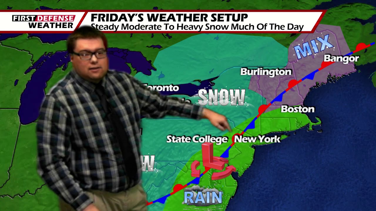
Colder air will then wrap around the back edge of the Low as is moves northward along the boundary, creating another changeover to all snow Thursday night through Friday. Indications suggest that a steady widespread snow will be likely throughout the day on Friday with moderate to heavy bursts at times.
As the winds start to shift more west-northwest, we may add a period of lake enhancement or true lake effect Friday afternoon into early Saturday morning, bumping up totals mainly along the the hillier terrain of the Southern Tier.
In terms of snowfall, most areas should be around one or three inches tonight through early Thursday with the majority of that being a rather sloppy accumulation.

A general three to seven inches are likely through early Saturday with some totals near nine or 10 inches along the hills with any added lake moisture.
While the majority of the weekend will be mostly dry, there will be the chance for a few spotty snow showers from time to time. We’ll start to moderate temperatures a little bit early next week with a chance for rain and snow showers both Monday and Tuesday.

WNYNewsNow is a proud Ambassador for the NOAA Weather-Ready Nation program.
![]()


Leave a Reply