App users, tap here to watch video
JAMESTOWN – Spring continues to be lost in the third dimension as cold air continues to surge into the region. We’ll be likely breaking a record come Saturday dry and chilly Mother’s Day is on the way.
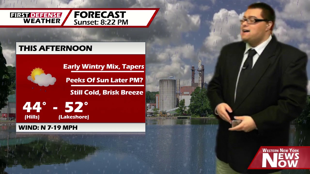
After a morning wintry mix near the New York/Pennsylvania line, the remainder of the day should be mainly dry with a small chance for a scattered shower this afternoon. There will be a bit of a breeze through the afternoon. Highs will range 44 on the hills to 52 near the Lake Erie shoreline. Wind: North 7-18 MPH.
With a clearing sky and light winds tonight, that will allow temperatures to drop quite a bit overnight, allowing the room fro some frost to develop across the region.
For this reason, the National Weather Service has issued a Frost Advisory for Chautauqua County, effective 1 a.m. tonight until 8 a.m. Thursday morning.

With lows dropping to the lower to mid 30’s along the inland areas away from the lakeshore tonight, frost can can cause serious damage to or even kill sensitive plants and vegetation. Make sure to cover them up tonight or bring them indoors.
After a mostly sunny start to the day on Thursday, clouds Weill thicken up with rain showers developing for the afternoon. A tad bit warmer but still below average. Highs 49 to 56.
A Cold front will move through Thursday night, bringing in more colder air once again. Highs will drop into the lower 40’s on Friday with on-again, off-again rain and snow showers.
After the frontal passage, the upper-level trough digs a little deeper into the northeast, sending in another wave of winter-like air for Saturday with more rain and snow showers at times. With this type of airmass over us, we have a chance of breaking an over 100-year old record low maximum high temperature in Jamestown.

Currently, the coldest May 9 in history occurred in 1902, where the high at the Jamestown Airport only reached 42 degrees. We are forecasting 36 for this Saturday. Should we be on the money with this forecast, Saturday will rank as the coldest May 9 in history dating back to 1890 when weather records starting being kept for the city.
While Mother’s Day is looking mainly dry, it will not be much better in the temperature department; only reaching the mid 40’s.

We will stay cold into next week with highs only in the 40’s with a few rain and snow showers possible on Monday with some partial sunshine on Tuesday.
WNYNewsNow is a proud Ambassador for the NOAA Weather-Ready Nation program.
![]()


Leave a Reply