App users, tap here to watch video
JAMESTOWN – It will continue to feel like summer tomorrow with afternoon popcorn storms. Some relief is on the way over the weekend with cooler temperatures and much lower humidity.
After an early shower or thunderstorm this evening, we’ll be left with mostly cloudy skies overnight. Remaining quite mild and muggy. Lows 62 in the valleys, 66 at the Lake Erie shoreline. Light south wind.
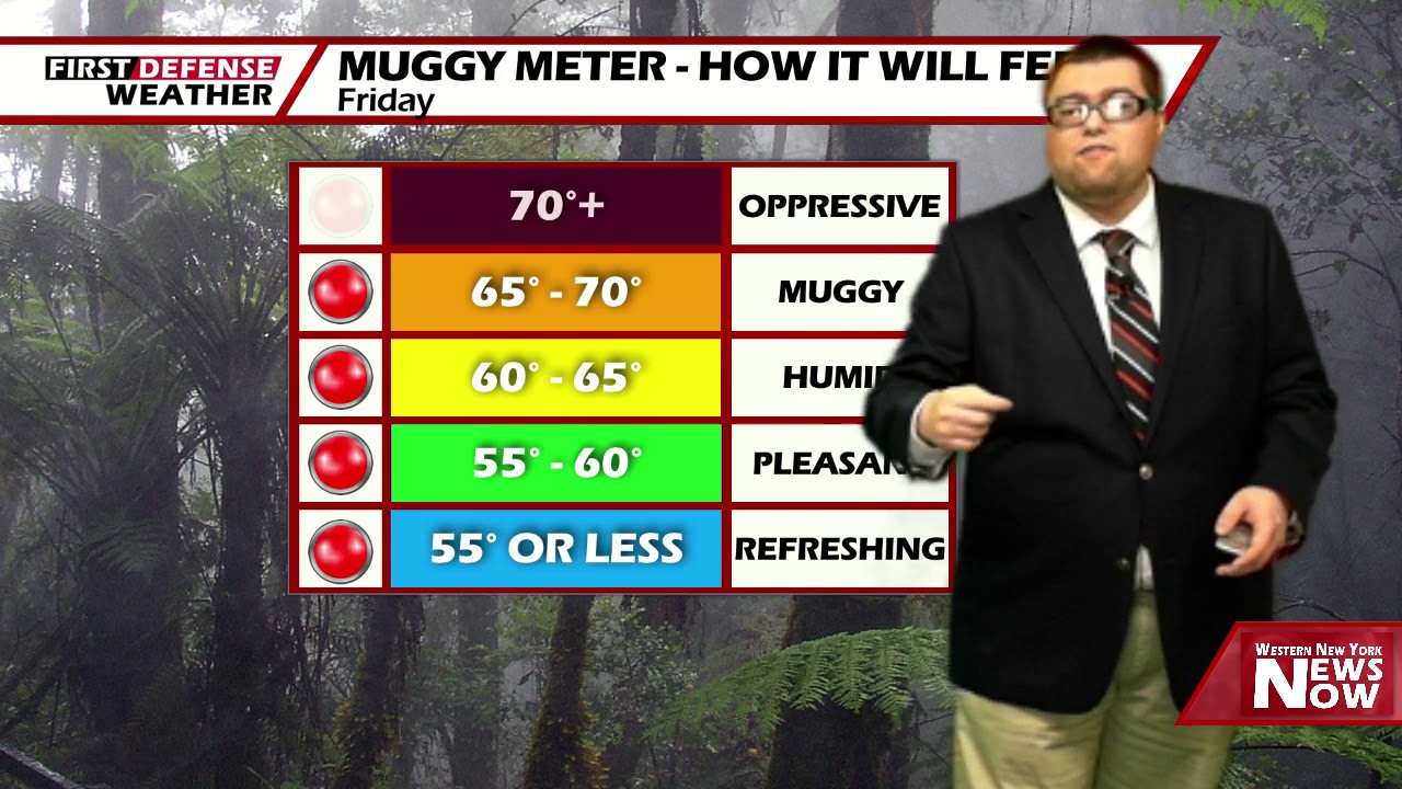
As the humidity rises to near- oppressive levels tomorrow, that will allow scattered and widely spaced showers and thunderstorms to pop up throughout the afternoon with the peak of the daytime heating.

Understand with this kind of airmass, these storms will form in random spots through the day and will be virtually impossible to predict when and where it is going to rain. Some spots will see a storm while others will see absolutely nothing but sunshine. Highs 78 to 86.
As a Cold front moves through over the weekend with a subsequent area of high pressure, humidity values will drop significantly on Saturday with lots of sunshine. Highs in the mid 70’s.
It will become a little bit cooler on Sunday with that high still dominating our weather pattern. Highs in the upper 60’s.

We’ll stay dray through early next week with a warmup trend starting back up once again. As the humidity slowly builds along with that warmth, a chance of scattered showers and thunderstorms will return on Tuesday with highs well into the upper 80’s.
WNYNewsNow is a proud Ambassador for the NOAA Weather-Ready Nation program.
![]()


Leave a Reply