JAMESTOWN – With high pressure firmly over the region, the next few days will feature plenty of sunshine. The heat and humidity will begin to build once again before a cold front passes mid-week.
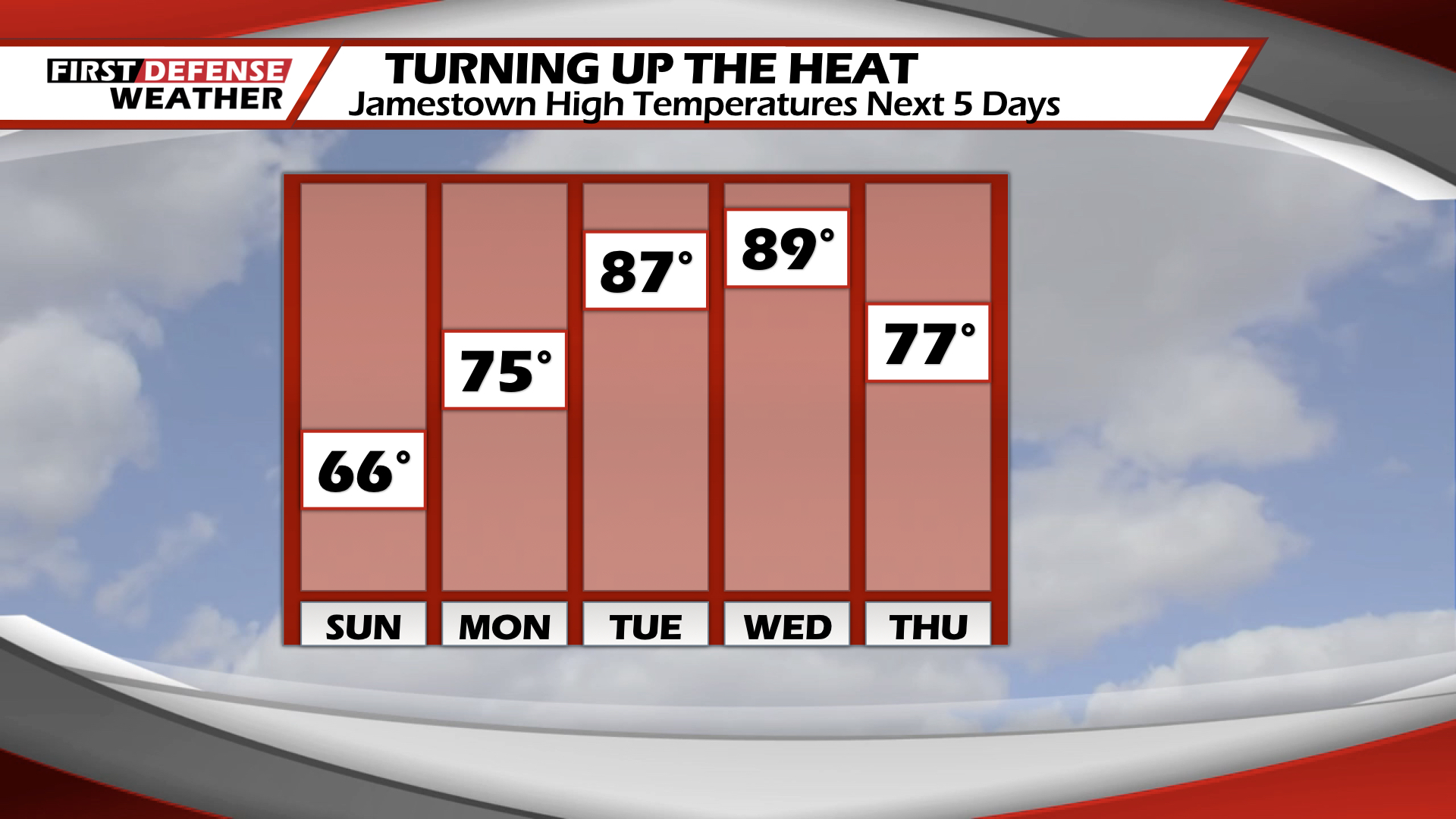
Sunday looks great. Mostly sunny skies with highs in the mid to upper-60’s. Cool and refreshing.
For tonight, clear skies will allow the temperatures to drop into the mid-40’s.
It begins to warm up starting tomorrow. With highs in the upper-70’s and more sunshine.
Tuesday the mercury really rises as will the humidity levels. Partly cloudy skies and highs in the upper-80’s to near 90.
Wednesday will remain hot with temperatures near 90. Some areas could see the lower 90’s . As the remnants of Tropical Storm Cristobal approach along with a cold front, chances for rain increase Wednesday. Behind this, temperatures will trend cooler for the remainder of the week.
WNYNewsNow is a proud Ambassador for the NOAA Weather-Ready Nation program.
![]()


Leave a Reply