App users, tap here to watch video
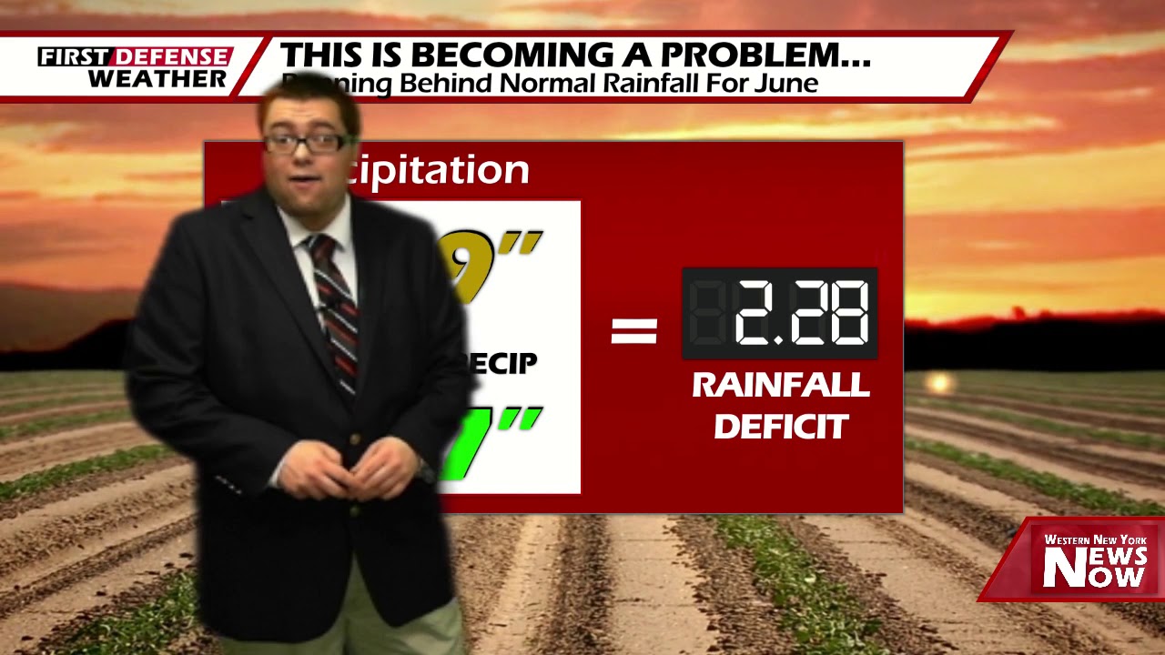
JAMESTOWN – A “Rex Blocking” area of high pressure will slowly start to slide out allowing for a surge of water and more humid air to infiltrate the region over the next couple of days, allowing for scattered afternoon storms to pop up each day.
After a mainly clear start to the evening, clouds will be advancing through the area overnight. Lows 53 in the valleys to 61 at the Lake Erie shoreline. Light wind.
As the humidity starts to ticks up tomorrow in combination with early sunshine breaks will bring the possibility for a few widely spaced showers and thunderstorms popping throughout the afternoon. Highs 77 to 84.
We will keep the chance for scattered afternoon showers and storms in the forecast through the weekend as the humidity continues to rise. Understand these storms will popup at random times in random spots during the afternoon and early evening. None of the upcoming days will be a washout with plenty of dry time. Highs in the mid to upper 80’s.

A better chance for more beneficial rain will come early next week with a couple waves of low pressure passing close to the region. Highs will be in the lower 80’s but with a good amount of humidity remaining.
WNYNewsNow is a proud Ambassador for the NOAA Weather-Ready Nation program.
![]()


Leave a Reply