App users, tap here to watch video
JAMESTOWN – The sun will be back out on full force on Friday before another storm system comes in for the weekend bringing widespread showers and thunderstorms to the region.
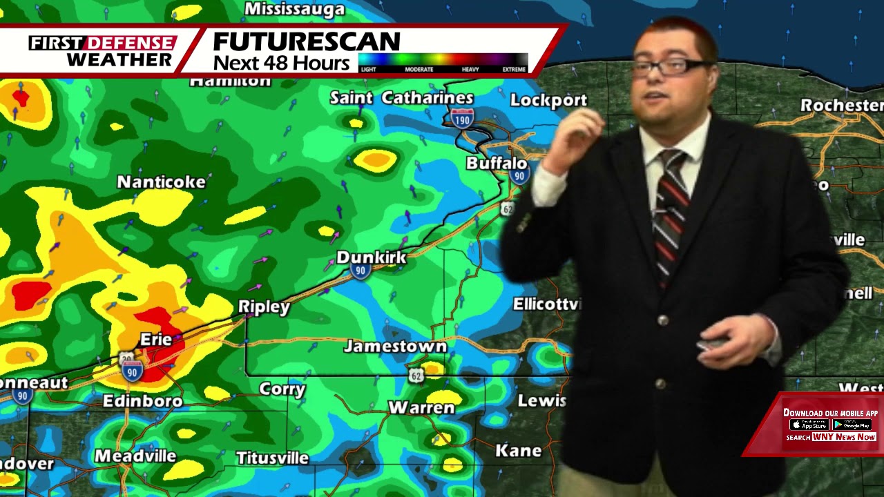
A weak area of high pressure is starting to erode which will allow a wave of low pressure to move close to the region spewing a few showers and thunderstorms from time to time. We’ll get one dry day in on Friday before a deep storm system arrives on Saturday with locally heavy downpours possible.
Early showers and thundershowers will fade away before midnight, leading to partly to mostly cloudy skies overnight. It will remain rather comfy. Lows 54 in the valleys to 62 at the Lake Erie shoreline. SW winds less than 10 MPH.
We will squeeze out a nice and dry day on Friday with lots of sunshine to go around. The humidity will tick up just a little bit but it won’t be too muggy. Highs 77 to 84.
A deep storm system will track northwest of the region Friday night, bringing several rounds of showers and thunderstorms. The NOAA Storm Prediction Center has placed the far southern portion of the Southern Tier and much of the Northwestern Pennsylvania under a low-end Marginal Risk, level 1 out of 5, for severe thunderstorms.

These storms will have the potential to produce heavy rainfall along with brief gusty winds at times. These showers and storms will continue into Saturday in widespread nature. While the temperature comes down into the upper 70’s, the humidity will spike making it feel warmer during the day.
A strong ridge of high pressure works in on Sunday giving us lots of sunshine and highs near 80.

That high will continue to dominate our weather pattern through much of the upcoming week with mostly sunny skies each day and highs in the lower 80’s.
WNYNewsNow is a proud Ambassador for the NOAA Weather-Ready Nation program.
![]()


Leave a Reply