App users, tap here to watch video
JAMESTOWN – This evening will start dry but showers and thunderstorms will be developing from west to east overnight with the chance some of them could be strong to severe.
The NOAA Storm Prediction Center has placed the far western Southern Tier and the western portion of Northwestern Pennsylvania under a standard Slight Risk, a level 2 of 5, for severe thunderstorms tonight.

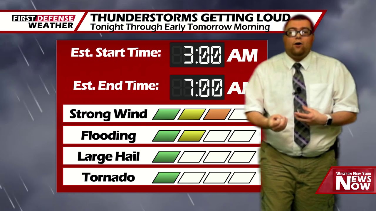
As a deep storm system moves northwest of the region overnight, showers and thunderstorms will be moving in between 3 a.m. and 7 a.m. Saturday morning. These storms will have the potential to produce damaging wind gusts and very heavy rainfall.

While getting severe weather cranking overnight is a bit tough, we do think there will be enough juice in the atmosphere to intensify a few of these storms. Make sure you have a way of getting watches and warning through the overnight.
Morning lows 62 in the valleys, 68 at the Lake Erie shoreline.
The worst of the weather on Saturday will be in the morning with widespread showers and thunderstorms. While the widespread nature will end by the afternoon, some scattered showers and storms will still be possible in the afternoon. While highs will range 76 to 83, the humidity will be up making it feel a bit warmer.
The pick day of the weekend will be on Sunday as high pressure makes a return bringing lots of sunshine with highs near 80.

That high will dominate our weather pattern into next week with lots of sunshine each day and highs in the lower 80’s.
WNYNewsNow is a proud Ambassador for the NOAA Weather-Ready Nation program.
![]()


Leave a Reply