App users, tap here to watch video
JAMESTOWN – The hottest air so far this summer is underway bringing with it an ocean of humidity with a few chances for some afternoon thunderstorms this week.
With a big heat bubble sitting over much of the northeast, temperatures along with the humidity will be soaring as the warm most air continue to be pumped in from the south.
Any cloud cover will clear out tonight leading to another great night for stargazing. Some patchy valley fog will be possible by morning. Temps will still be up a bit however. Lows 63 in the valleys, 69 at the Lake Erie shoreline. Light winds.
Tuesday starts dry with lots of sunshine but thanks to a lot of humidity in the air and the early sun, some scattered, random afternoon showers and thunderstorms will be popping up throughout the day. Understand, the day will not be a total wash with some spots getting absolutely nothing in the rain gauge. Very hot. Highs 85 to 94.
There will be a another chance for a spotty afternoon shower to storm Wednesday afternoon otherwise lots of sun and baking heat. Highs 85 to 93.
Heading into Thursday, this will likely be the peak of the heat as highs will flirt with 90 around the city. A strong July sun along with relatively dry ground conditions will help aid in the temperatures climbing.
There will be the chance for afternoon scattered showers and storms once again on Friday with high nearing 90 once again.
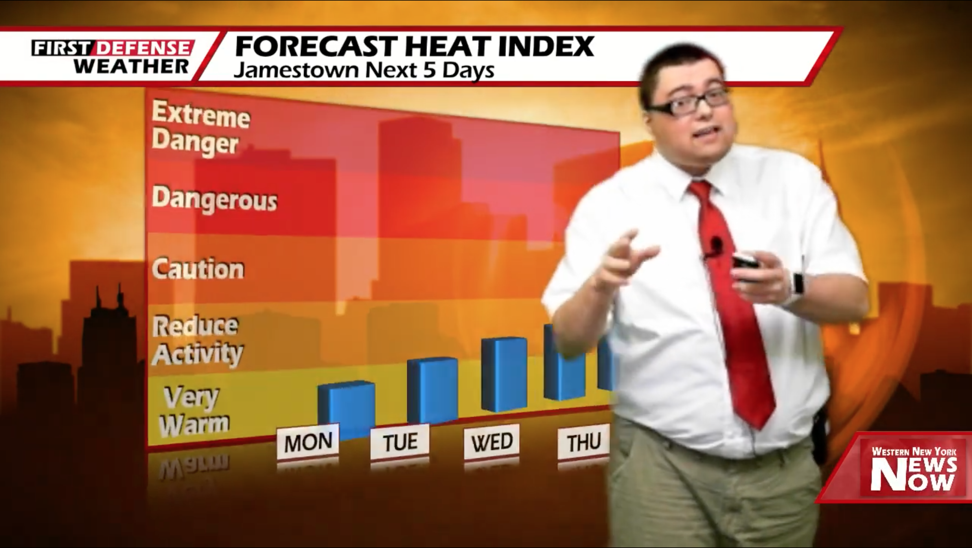
During this time period, the heat index or the “Feels Like” temperature will be well into the mid 90’s to hovering near 100 degrees. While there is a Heat Advisory to our north that includes the Buffalo metro area, we would not be shocked if the National Weather Service opts to extend that Advisory down into the Southern Tier for late week.

Per NWS Buffalo criteria, a heat index of at least 95 degrees must be forecast to warrant the issuance of a Heat Advisory while an index of 105 degrees meets Excessive Heat Warning criteria.
A cold front moving through over the weekend will provide a batter chance for showers and thunderstorms both Saturday and Sunday with some release from the heat and humidity.

WNYNewsNow is a proud Ambassador for the NOAA Weather-Ready Nation program.
![]()


Leave a Reply