App users, tap here to watch video
JAMESTOWN – Break out those sweats and that pumpkin spice as some true fall-like air will be invading the region with some showers possible during the second half of the weekend.
The front that has been hung over the area has finely budged its way southward as the forward push of cool air north of the font is stronger than that of the incoming warmer air to the south. With our wind direction shifted more north-northwest, that will keep us below average for much of this upcoming period.
Mostly cloudy skies will take us through the overnight tonight. Cooler and less humid. Lows 52 in the valleys, 59 at the Lake Erie shoreline.
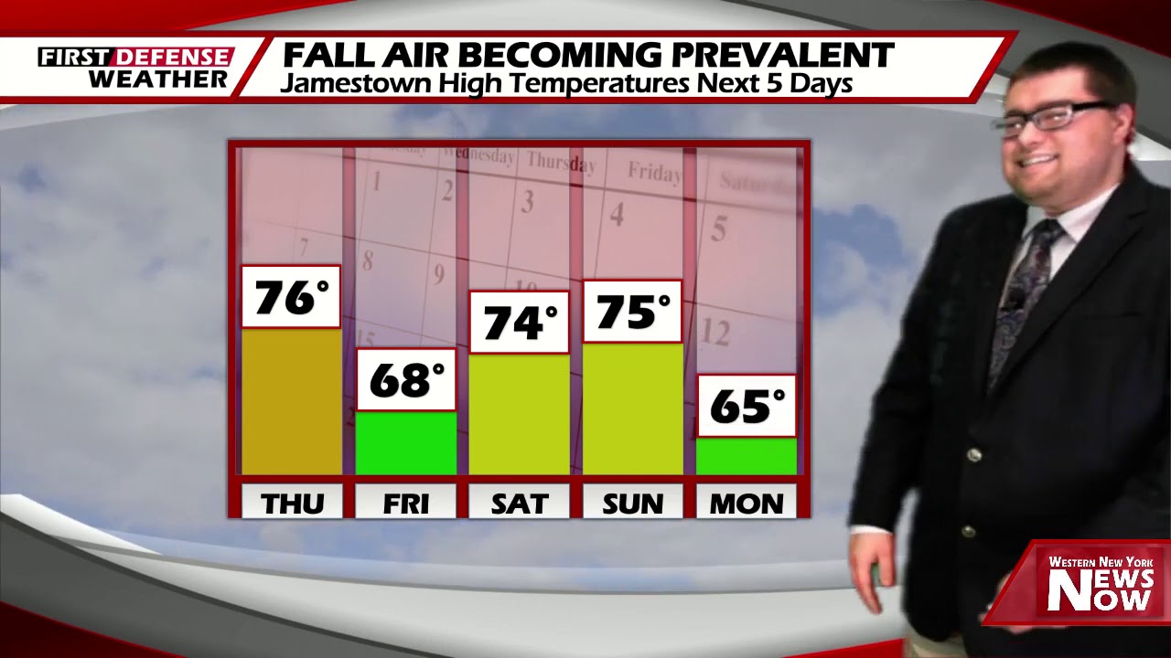
Even though the sun will be out in good amounts on Friday, an increasing north to northeast wind will hold down our temperatures throughout the day. Highs 64 to 73.
A clearing sky Friday night will allow temperatures to dip back by the morning hours on Saturday; 43 to 53.
Clouds will be on the increase on Saturday in advance of a disturbance pulling up into the Great Lakes. There will be the chance for an isolated shower late in the day. Highs in the lower 70’s.

As the system moves directly over us on Sunday, showers and a few rumbles will be commonplace throughout the day. Highs in the mid 70’s.
High pressure will return next week brining back the sunshine but cooler than average temperatures both Monday and Tuesday with highs in the mid to upper 60’s.
WNYNewsNow is a proud Ambassador for the NOAA Weather-Ready Nation program.
![]()


Leave a Reply