App users, tap here to watch video
JAMESTOWN – We will be ringing in fall tomorrow with lots of sunshine to go around with chilly air then it’s back to the milder stuff throughout the rest of the week.
High pressure set up to our northeast over New England is providing us some fantastic weather albeit chilly. That will be changing as we work our way throughout the week as a surge of milder air pushes in bring highs back to the 70’s.
Another mainly clear night will be shaping up tonight with some patches of frost developing overnight inland away from the Lake Erie shoreline. Still rather chilly. Lows 34 in the valleys, 48 at the lakeshore.
The Fall Equinox officially occurs at 9:30 a.m. Tuesday morning, meaning that the suns solar rays are hitting directly at the Earth’s equator.

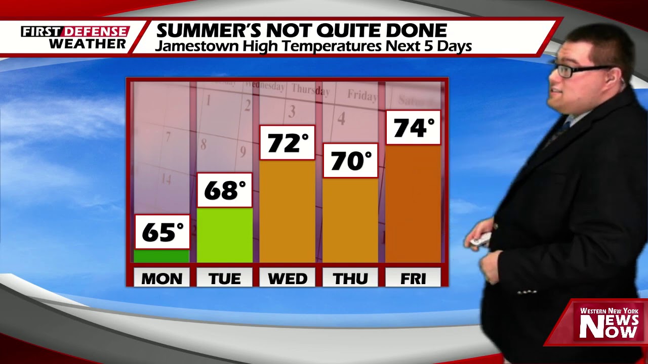
The Equinox occurrence marks the official start of Autumn and sunshine will be the story for the first official day of the new season. Temperatures remaining rather fall like. Highs 65 to 74.
Sunshine will continue on Wednesday with a few clouds dotting the sky from time to time. Milder. Highs 67 to 76.
There will be more clouds to tend with on Thursday but an overall dry day with the sun poking through the clouds. Highs in the lower 70’s.
Mostly sunny skies will be back on Friday with highs in the lower 70’s.

As we head into the weekend, we’ll start dry with lots of sun on Saturday and highs in the upper 70’s. As trough pushes its way towards the region, there could be a spotty shower or two across the area on Sunday but the chance is rather small; 30 to 35 percent as it stands now. The majority of the day will be dry with partial sunshine and highs in mid 70’s.
WNYNewsNow is a proud Ambassador for the NOAA Weather-Ready Nation program.
![]()


Leave a Reply