
App users, tap here to watch video.
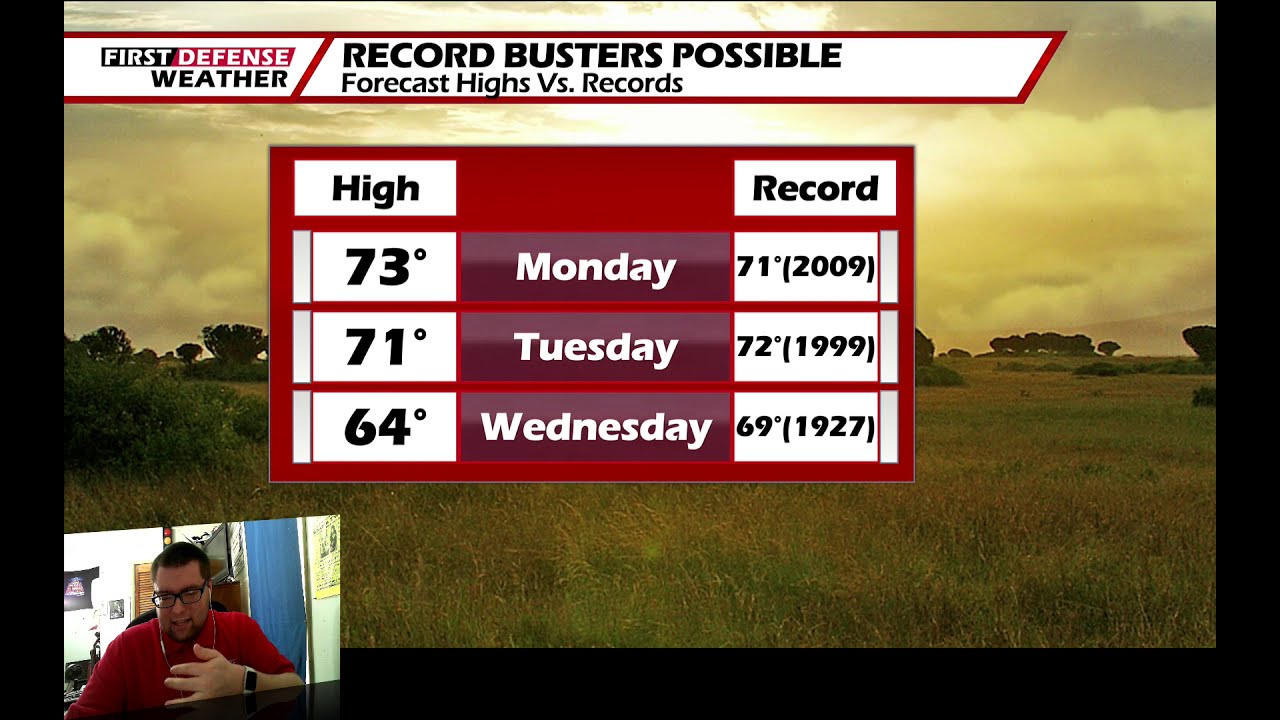
JAMESTOWN – Sunshine will prevail through the day on Tuesday with highs near record levels once again but some rain will come our way on Wednesday.
High pressure continues to dominate over the northeast which will leave us with mainly clear skies and unseasonable warmth. A cold front will cross the region on Wednesday and will trigger off some scattered rain showers on Wednesday before we dry out for the rest of the week.
Clear and starlit skies will take us through the night. Lows 45 in the valleys, 56 at the Lake Erie shoreline.
Sunshine will continue in good force on Tuesday with near record warmth yet again. Highs 68 to 76.
A cold front will march towards the region Tuesday night and trigger off some scattered rain showers through the day on Wednesday. Highs in the lower 60’s.
Sunshine will be back in good supply on Thursday and Friday with highs in the lower 50’s.
The weekend will start dry and cool with a good amount of sun and highs near 50.

We’ll bring in a chance for a scattered shower or two on Sunday with partial sunshine and highs in the lower 50’s.
WNYNewsNow is a proud Ambassador for the NOAA Weather-Ready Nation program.
![]()


Leave a Reply