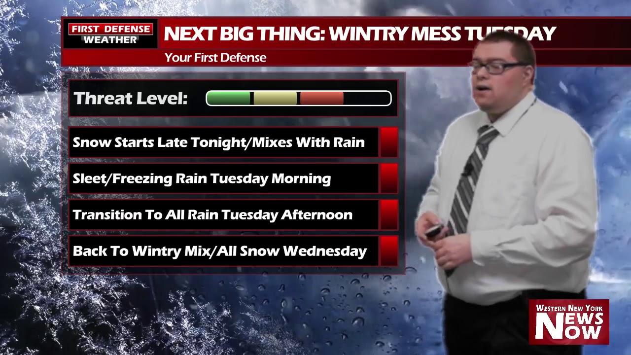
JAMESTOWN – A impactful winter storm is on its way to Western New York with a little bit of everything in the mix, creating a very messy and sloppy commute. The National Weather Service has issued a Winter Weather Advisory for all of Western New York, going into effect at midnight tonight and running through 10 PM on Tuesday.  Precipitation will began after midnight tonight as the center of the storm passes close to the region. We will first start out with snow, changing quickly over pockets of sleet and freezing rain. This wintry mix will create slick travel for the Tuesday morning commute. As warmer air works into the storm, a changeover to all rain will occur during the late morning and early afternoon hours on Tuesday. Rainfall shouldn’t be all that heavy but some pockets of moderate downpours are possible. More sleet will work in late Tuesday as colder air is yet again, pulled back into the storm, with one final changeover occurring to all snow for Tuesday night into Wednesday. In terms of accumulations, snowfall will not be a huge issue; most will see totals between 2 to 4 inches with some amounts possibly up to 6 inches. We can handle that.
  What will become a problem is the ice. Here is one ice total suggestion from one of the computer models we have in the weather center. I don’t fully agree with these totals down to the exact hundredth, feeling this model is overestimating a tad bit, but ice accumulations nearing the quarter of an inch mark are possible, especially in the western Southern Tier and northern PA.
  We think with the advent of the sleet, that will help to hold down ice accumulation a little bit. However, very slippery travel is likely early Tuesday on untreated roadways. Give yourself some extra time and drive carefully. A brief warmup is on the way towards the end of the week when temps make it back into the 40’s again for Friday before temps fall into the 20’s for the latter part of the weekend.

WNYNewsNow is a proud Ambassador for the NOAA Weather-Ready Nation program.


Leave a Reply