JAMESTOWN – Today is the final day of temps in the 60’s for awhile as we will begin to get a series of fronts to moves through Western New York over the next 36 or so hours.
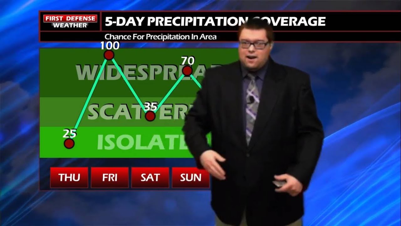
The afternoon today will be mainly dry albeit not as much sunshine as we had on Wednesday. While a couple computer models we have in the weather center are trying to spit out a few isolated showers across the Southern Tier through the afternoon but with dew points down into the 30’s, the air is still a little too dry to allow that rain to actually reach the ground. We won’t rule it out however.
The better chance for rain will come near sunset as a Low pressure area currently over Arkansas continues to move northeast, dragging a boat-load of Gulf moisture with it.

A Warm front that is out ahead of this system will push through overnight keeping lows in to the upper 40s to mid 50s. There is a possibility the temperature will start to rise few degrees before sunrise tomorrow morning.
Rain will be story throughout the day on Friday as that Gulf moisture continues to infiltrate the region. Depending on the exact track of the actual Low, there could be a couple rumbles of thunder as well.

A Cold front will follow right behind and will drop temperatures back into the upper 30’s for Saturday morning with the rain turning more scattered in nature with temps in the lower 50’s.
There is still a little disagreement with the computer models on a bulge of colder air currently sitting over Canada and where the Jet Stream will dump that air. Based on current data, the potential does exist for some wet snow flakes mixed with rain late Saturday night and early Sunday with temps struggling to reach the lower 40’s for daytime highs.
Limited rain chances continue into early next week with temperatures making it back to near 60 by next Wednesday.

Storm Spotter Training: The National Weather Service in Buffalo will be conducting their first ever online training class on Tues., May 2 at 7:00 p.m. For the online training, you do need to pre-register as spots for the online are limited. You can register your spot a http://www.weather.gov/buf/skywarn

Attendees will learn many topics to become a trained storm spotter, such as identifying storm structure, basic meteorology relating to severe convection (severe thunderstorms, tornadoes, etc), severe weather safety, and proper reporting techniques.
WNYNewsNow encourages everyone to attend a training session; the weather industry is in desperate need of more trained spotters. What many people may not know is that spotters actually contribute to the warning process. Remember, Doppler radar looks above the ground; it’s only spotters who see what is happening down at the ground.
WNYNewsNow is a proud Ambassador for the NOAA Weather-Ready Nation program.
![]()


Leave a Reply