JAMESTOWN – After a rather cloudy and milder Wednesday, showers and storms will fire tomorrow with the potential that some of them could be severe.
Throughout the afternoon today, clouds will be on the increase across the area. There is the chance of catching a shower or two but the overall chance is small; about a 20 percent chance.
As a Warm front approaches tonight, scattered showers will develop out ahead and along the front. There could be a few rumbles of thunder early tonight however we are not expecting any problems out of that.
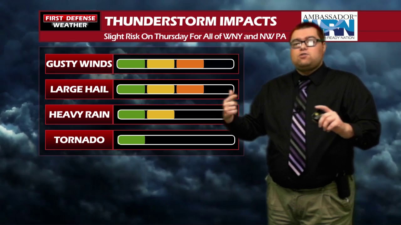
The NOAA Storm Prediction Center maintains the Slight Risk (level 2 out of 5) for severe thunderstorms on Thursday across all of Western New York and Northwestern Pennsylvania.

New indications suggest this will be a late morning and mid afternoon event, with the main timing window between 11 a.m. and 5 p.m. Thursday. The key take away is the fact that not everybody will see a storm tomorrow during this time frame; the activity will be rather localized in nature.

Where storms do fire up, they do have the potential to become severe with damaging winds and large hail as the main threats. While there is a very low tornado risk, an isolated tornado cannot be ruled out.

Humidity values will also be on the rise with model guidance suggesting Dew Point temperatures ranging form the lower to mid 60’s across the area. The higher amounts of moisture in the air will also account toward popup thunderstorm activity.
High resolution Mesoscale guidance shows these storms moving through at a rather fast clip, possibly upwards of 60 MPH or higher, supporting the damaging wind threat.
A Cold front will follow behind this activity, clearing us out for Thursday night and into Friday with cooler temperatures and lower humidity.
Saturday will become warm and humid once again with more widespread showers and thunderstorms. Rain become more widely spaced for Sunday and Memorial Day with temps going back into the upper 60’s early next week.

WNYNewsNow is a proud Ambassador for the NOAA Weather-Ready Nation program.


Leave a Reply