JAMESTOWN – Western New York is gearing up for the hottest weather we’ve seen so far this summer with very oppressive humidity levels and dangerous heat indices Friday and Saturday.
The National Weather Service in Buffalo has issued a heat Heat Advisory for the entire Southern Tier, going into effect 12 PM Friday and lasting until 6 PM Saturday. There is also an Excessive Heat Warning in effect for areas that border the south shore of Lake Ontario until 6 PM Saturday.

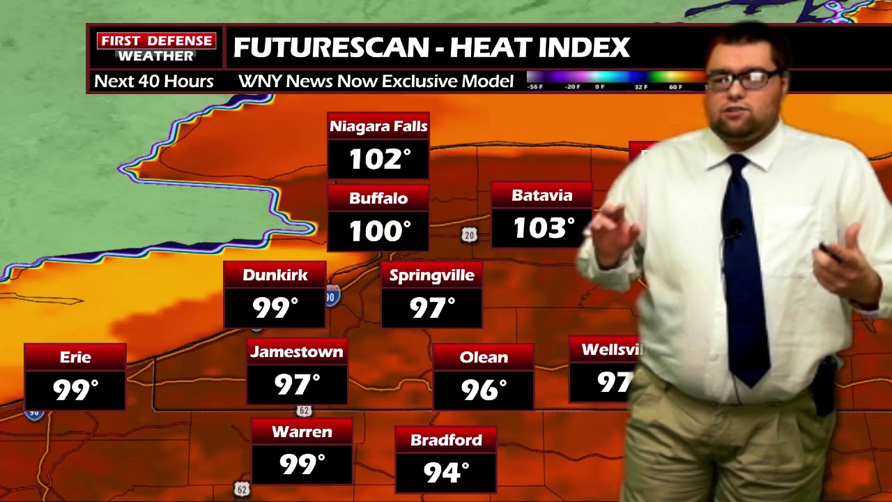
Actual air temperatures will range between 87 and 94 degrees both days. That’s bad enough but with the very tropical and saturated air in place across the region, it will feel more like the mid 90’s to lower 100’s. Some spots may reach 110 heat index at times. That is a dangerous level of heat and one you do not want to be in for long periods of time without some way to say cool.

As we’ve stated before, hitting 90 degrees down in the Southern Tier can be a bit of a challenge. We don’t see 90 or above very often down here, mainly due to our terrain with hills and valleys. We have dug through the books and looked at past heat waves as analogs. We do think if we get enough sunshine to bake the area on Friday and Saturday, we do have a good chance of hitting that 90 degree mark both days.
Some relief is on the way next week as the winds aloft will tend to favor a cooler pattern, equating out to below average highs and much more human comfort.

WNYNewsNow is a proud Ambassador for the NOAA Weather-Ready Nation program.
![]()


Leave a Reply