JAMESTOWN – A strong cold front passing by the area will provide for a wet, dreary, and raw next couple of days. High pressure however, will begin to build back in by the weekend, allowing for the temperatures to warm back into the 60’s.
Today will be a good day to stay inside and watch a movie. Showers and a few thunderstorms throughout the afternoon. High temperatures have already occurred very early this morning; 55 at the Jamestown Airport at 6 a.m. We will be dropping to the mid to upper 40’s as the afternoon progresses.
It will be breezy as well with a heathy west to southwest wind 15 to 25 MPH with some gusts possibly near 30 MPH at times through the afternoon.
Tonight will remain cloudy with rain showers continuing. The wind will also tick up to 25 to 35 MPH with gusts near 45 MPH through the overnight. Morning lows 40 to 47.
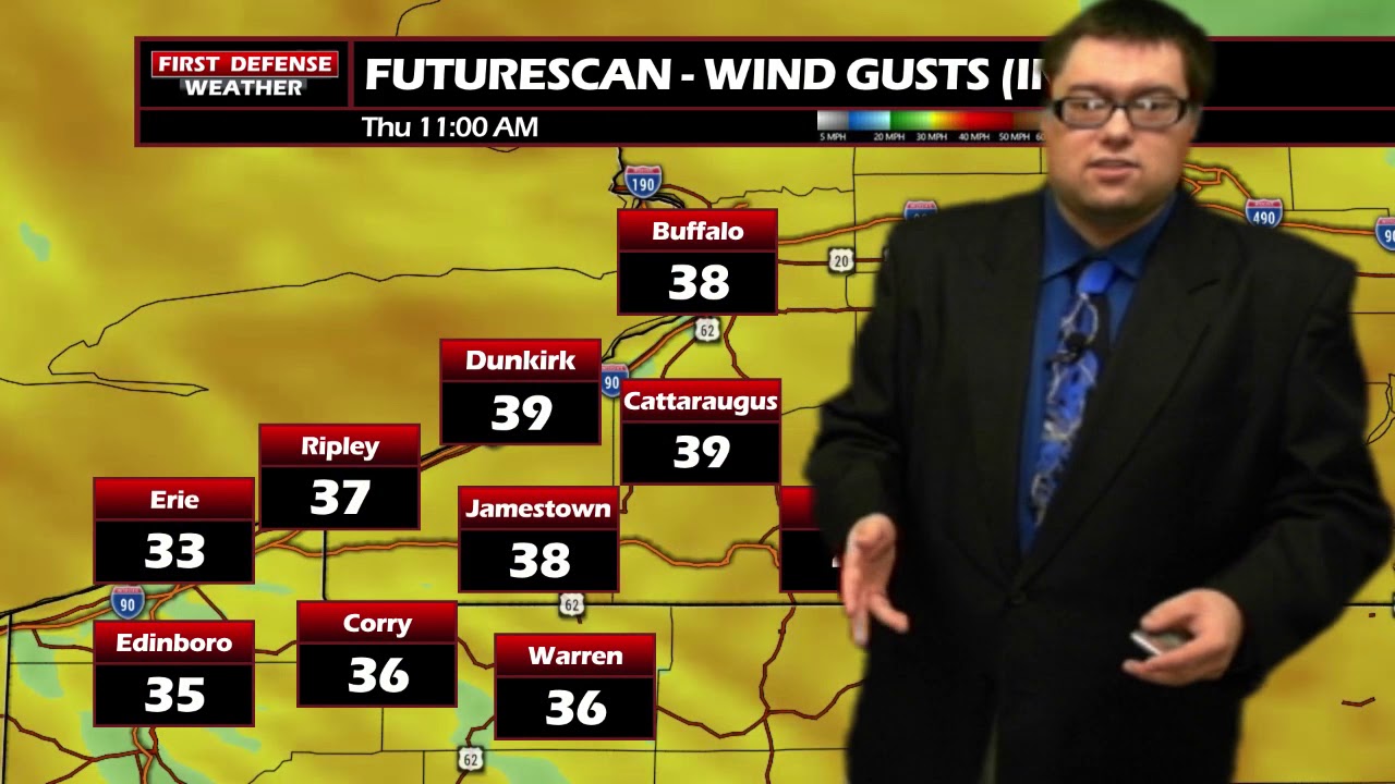
In the wake of the Cold front passing by, Thursday will see temperatures struggle to make it out of the lower to mid 40’s. Rain showers will continue, some of the lake effect variety as the cooler north-northwest wind crosses the relevantly warmer waters of Lake Erie. Wind gusts early on Thursday could be near 35 to 40 MPH, before dismissing through the afternoon.

As high pressure begins to build back in for the weekend, Friday will begin to dry out with mostly cloudy skies and temperatures in the low 50’s.

Both weekend days are looking dry for now, with temperatures rebounding into the low to mid 60’s.
WNYNewsNow is a proud Ambassador for the NOAA Weather-Ready Nation program.
![]()


Leave a Reply