JAMESTOWN – The widespread snow associated with the storm system has ended but in the wake of that, lake effect snow will continue, adding additional snow accumulations. Lows will likely be close to record temperatures by the morning.
The National Weather Service in Buffalo has issued a Winter Weather Advisory for Lake Effect Snow, going into effect at 7 p.m tonight and running through 10 a.m Wednesday morning for Chautauqua and Cattaraugus Counties.

The National Weather Service in Cleveland has extended the Winter Storm Warning for Erie and Crawford Counties in Pennsylvania until 1 p.m. Wednesday.
Bands of lake effect snow will continue with moisture from our source region from Lake Huron. Throughout the afternoon, some spots may pick up around 1 to 3 inches, with the highest totals along the higher terrain.
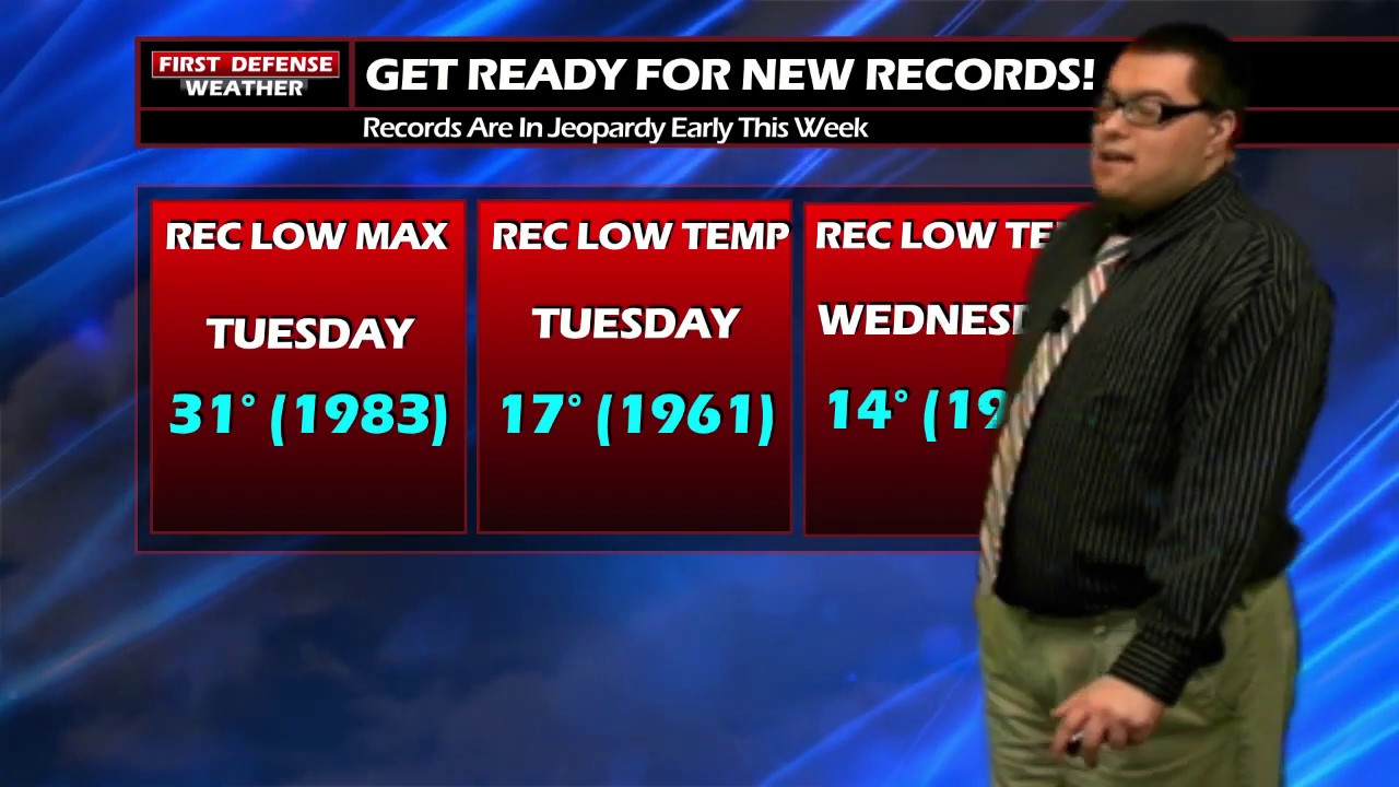
Temperatures will struggle through the day as well. The lowest observed high temperature for this date on record is 31, set in 1983. With our highs held down into the 20’s, that should officially break that record by the end of the day.
Lake snow will continue in pockets tonight and turning very cold. We’re forecasting a low temp range between 12 and 20, which should break the record low for the City of Jamestown, which is 17, set in 1961.
With temperatures that cold, it will not take much to produce a wind chill factor through the overnight. Wind chills could reach the single digits with some possible sub-zero values, especially in the colder pockets of the region.

Most areas will pick up and additional 2 to 4 inches with totals upwards of 3 to 6 inches on the hills.

Any lake effect snow will cut out by the afternoon hours on Wednesday with some limited peaks of sun possible. Highs 22 to 28.
Rain and snow showers are possible both Thursday and Friday with highs still well below average into the mid 30’s.

We do see a warmup trend by the second half of the weekend into early next week, bringing temperatures closer to average Sunday and Monday with sun and clouds.
WNYNewsNow is a proud Ambassador for the NOAA Weather-Ready Nation program.
![]()


Leave a Reply