JAMESTOWN – After our high of 46 degrees that occurred at 2 a.m. this morning, temperatures have steadily been dropping through the 30’s this afternoon. The weekend is looking good before a tricky weather situation arrives for parts of the holiday week.
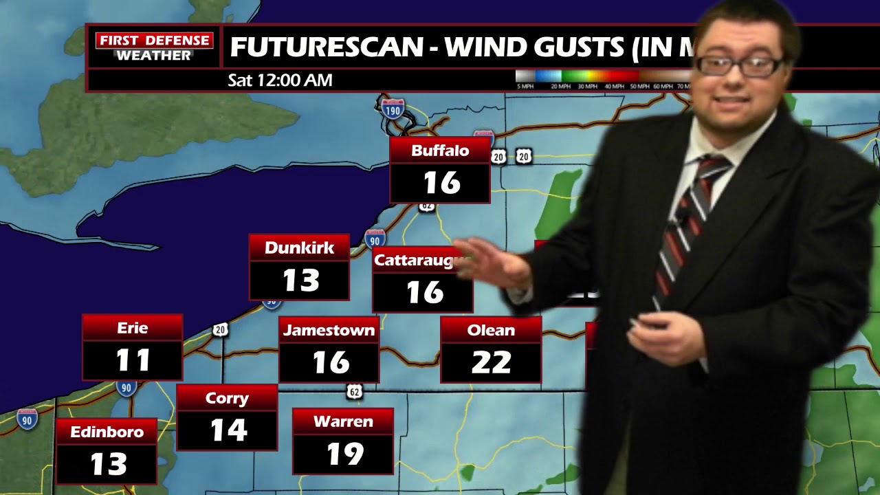
After the passage of the Cold front, cooler air has been allowed to infiltrate the region with more cloud cover. Most areas will end the day between 28 and 36 with a healthy northwest wind 15 to 30 MPH. Some wind gusts could still be near 40 MPH at times before the wind gradually diminishes.
A quiet weather night is in store with partly to mostly cloudy skies with lows 22 to 29.
Saturday will be a great day with plenty of sunshine and temperatures nearing the averages for this time of the year; 42 to 48.
A couple rain or snow showers will arrive Saturday night with temperatures hovering near freezing. Any snow accumulation will be minor in nature; less than a quarter inch if anything.
A couple snow flurries may linger into the morning hours on Sunday, becoming partly sunny for the afternoon. Highs in the lower 40’s.
Monday and Tuesday of next week will be fine weather days with partial sunshine each day and temperatures going above average into the mid to upper 40’s. Some spots may actually come close to 50 degrees on Tuesday.
As we head into Wednesday, this is where things starts to become dicey. There is a good amount of agreement within the computer models that a storm system will move though the Great Lakes during this time period. The question remains on the exact path the storm will take and how close does it come to the region.
There could be another threat of strong to potentially damaging winds on Wednesday if the storm alines a track that passes to the northwest of the region.
There is also the potential for some lake effect snow showers to setup off the southeastern end of Lake Erie Wednesday night heading into Thanksgiving day as colder air looks to drag across the warmer lake waters. Intensity and subsequent placement of said lake effect is still very much question at this time.
With all of that said, we are still too far out to give exact details on this storm. We will get better quality data we go throughout the weekend and into early next week at which point, we will have a better understanding of the storm and any impacts we could see.

WNYNewsNow is a proud Ambassador for the NOAA Weather-Ready Nation program.
![]()


Leave a Reply