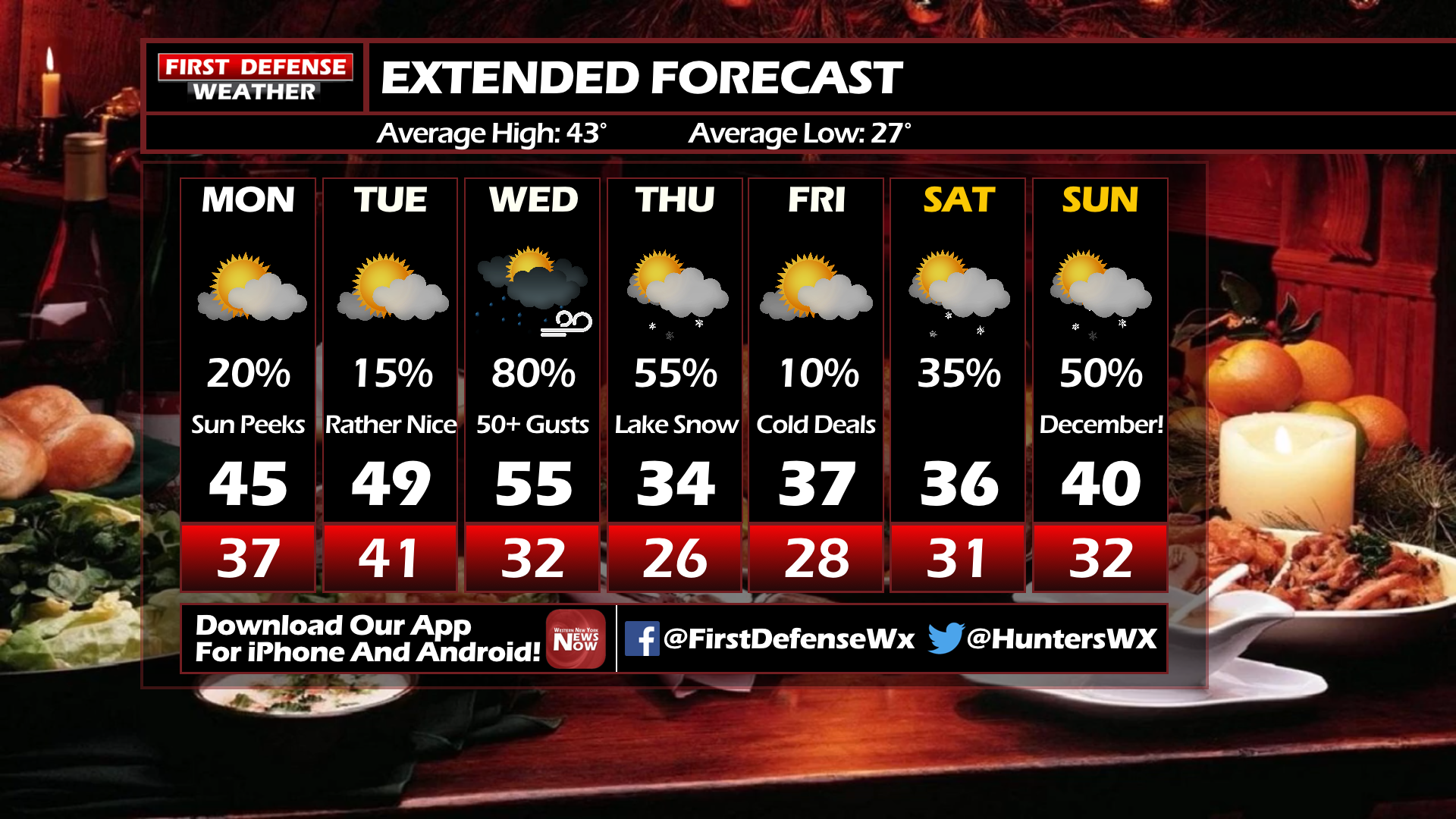
JAMESTOWN – Monday and Tuesday will be decent weather days across Western New York, with not much to write home about. A potent storm system crossing the region Wednesday will bring widespread rain and strong gusty winds.
After a cloudy start, the rest of this afternoon will be partly cloudy with temperatures in the mid to upper 40’s. Tonight will be mostly cloudy with lows in the upper – 30’s.
Tuesday will be another dry and sunny day across the area with temperatures peaking around 50 to the lower 50’s.
Wednesday is where things begin to change. The day will start off with temperatures in the upper 50’s, but as a storm system passes to the north the temperatures will drop through the 40’s and into the 30’s. It will be a cloudy, rainy, and windy day.
A High Wind Watch will go into effect early Wednesday morning and last until late Wednesday evening. Winds will be sustained at 30-40 mph with gust near 60 mph.

Behind the storm system, the winter feel will return. As of now Thanksgiving looks to be rather cloudy with snow showers around. It is still too early to determine if any accumulation will happen. Temperatures on Thursday will be in the low-to-mid 30’s.
WNYNewsNow is a proud Ambassador for the NOAA Weather-Ready Nation program.
![]()


Leave a Reply