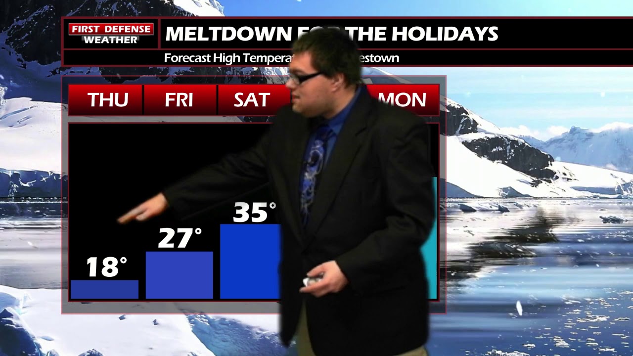
JAMESTOWN – While the majority of the snow has ended, temperatures will remain well below average through the afternoon. A change in the weather pattern by the weekend will result in an influx of milder air coming in that doesn’t bode well for our White Christmas hopes.
The lake effect snow machine has run out of fuel and has been shutting down through the day. There still could be a few leftover light snow showers or flakes this afternoon but the majority of the region with remain quiet. Struggling highs 16 to 25 with a southwest wind around 10 MPH.
Any leftover snow flakes come to an end the evening, otherwise partly to mostly to cloudy and rather cold. Lows 9 to 15.
Friday will be a nice day with partly to mostly sunny skies but still remaining chilly. Highs 24 to 31.
As we head into the weekend, a shift in the upper air winds aloft will equate out to “milder” air surging its way into the region with a developing strong High pressure ridge. While we’re using the term “mild” loosely, temperatures will climb to average values, nearing 40 degrees by next Monday.

While some may enjoy that milder air, this will not be good news for our White Christmas chances. We have been discussing all week about this recent lake effect event was going to be out best hope to add enough snow that could withstand the impending meltdown.
While areas in the hills did pick up over a foot of fresh snow, totals were a bit lower along the lower elevations than the projected amounts. For this reason along with the current forecast temperatures trends, our chances for a White Christmas have been substantially reduced.
With that said however, there is a glimmer of hope that maybe we can keep just enough of the snowpack to cover the ground come Christmas. A White Christmas is officially defined as having at least one inch of measurable snow on the ground on Christmas morning.

Temperatures will remain above average in the lower 40’s for both Christmas Eve and Christmas Day with more cloud clover on Wednesday.
WNYNewsNow is a proud Ambassador for the NOAA Weather-Ready Nation program.
![]()


Leave a Reply