JAMESTOWN – With a weak Cold front moving north to south, there will be the chance for a couple rain and snow showers across the Southern Tier this afternoon. We’ll be in good shape through the middle of the week before a real shot of Arctic air comes in Thursday and Friday.
High temperatures for the day have already occurred early this morning. Thanks to the advancing front, temperatures will slip back into the upper 20’s to lower 30’s through the afternoon with a small chance for a rain or snow shower. Otherwise, mostly cloudy to overcast.
Any rain or snow showers cut out this evening leading to mostly cloudy skies for the overnight. Morning lows 20 to 28.
Tuesday will be a mostly cloudy but a dry day with highs 32 to 37.
There is a small chance for a rain or snow shower in the afternoon on Wednesday otherwise partial sunshine with highs in the mid to upper 30’s.
As we head into Thursday, a big shift in the weather pattern will take place, setting the stage for some true wintertime air to invade Western New York. As it stands now, a widespread snowfall is likely Thursday though Thursday night but amounts are still questionable. It does seem as though a preliminarily range is between few inches and a plowable accumulation.

A strong Arctic front will plow through the region Thursday night, dropping morning lows well into the single digits with a bitter sub-zero wind chill likely overnight.
The frontal passage will act as a highway for Arctic Canadian air to pour into the area on Friday with pockets of lake effect snow setting off of the the eastern end of Lake Erie. Highs will struggle to reach double digits readings through the day with a robust north-northwest wind producing a bitter wind chill.
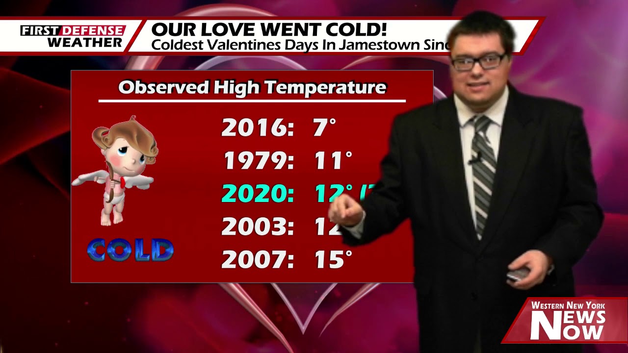
We are keeping our forecast high for the City of Jamestown at 12 degrees on Friday. If we achieve that high, that would go down as the third coldest Valentine’s Day on record stretching back 100 years since 1919.

Single digits lows are likely again Friday night with sub-zero reading possible along the valley locations of the Southern Tier.
After a very cold start on Saturday, we’ll rebound nicely into the lower 30’s thanks to plentiful sunshine through the day. A few scattered snow showers are possible on Sunday with highs making it back to near 40 degrees once again.

WNYNewsNow is a proud Ambassador for the NOAA Weather-Ready Nation program.
![]()


Leave a Reply