JAMESTOWN – The rain showers will begin to taper off this afternoon but in the wake of that, limited lake effect flakes will setup later tonight and into the day on Wednesday.
It will remain breezy through the day with a southwest wind 15 to 30 MPH with wind gusts up to 40 MPH at times. Highs 37 to 42.
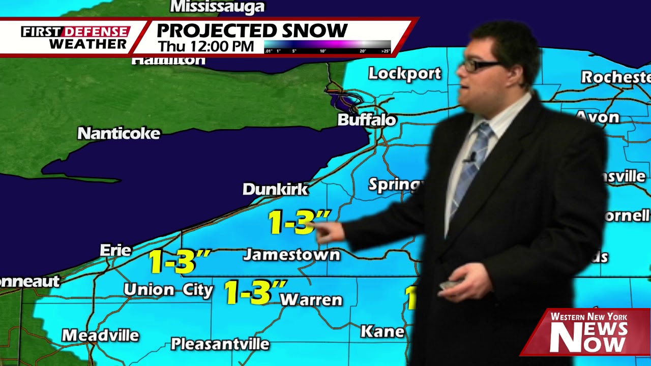
As we head into tonight, an approaching Cold front will trigger off a few snow showers late tonight which will then turn into scattered light lake effect snow showers as the winds shift west-northwest off the eastern end of Lake Erie. Any accumulation will be minor however; less than an inch is most spots. Lows 20 to 25.
Light lake snow showers will continue in pockets through the day tomorrow with again, around an inch of accumulation possible. Otherwise, mostly cloudy intervals for the afternoon and colder. Highs 22 to 29.
Behind the frontal passage, another shot of Arctic air will be making its way into Western New York later in the week. Lows will likely slip back into the lower teens Wednesday night into Thursday.
There still will be the chance for a few limited lake snow flakes with less than an inch of accumulation. Highs will only be in the mid to upper teens with lows Friday morning likely in the upper single digits.

Even though there will be a great supply of sunshine on Friday, that northerly wind flow will still dominate and will keep our highs down into the mid to upper 20’s.

Heading into the weekend, a surge of “warmer air” will flow in with a more southernly aloft, bring highs back to near 40 for both Saturday and Sunday with partly to mostly sunny skies.
A weak disturbance scooting by close to the region early next might through a few rain and snows into Western New York on Monday with above agers highs in the upper 30’s to lower 40’s.
WNYNewsNow is a proud Ambassador for the NOAA Weather-Ready Nation program.
![]()


Leave a Reply