JAMESTOWN – Hold onto those hats! While we will be enjoying a nice Easter Sunday, the weather will be changing in a drastic way on Monday with very strong winds and a few thunderstorms.
A deep storm system located over the Southern United States will be tracking northwards through the Upper Great Lakes tonight through Monday, initially leaving us on the warmer side of that storm as it moves to our north and west.
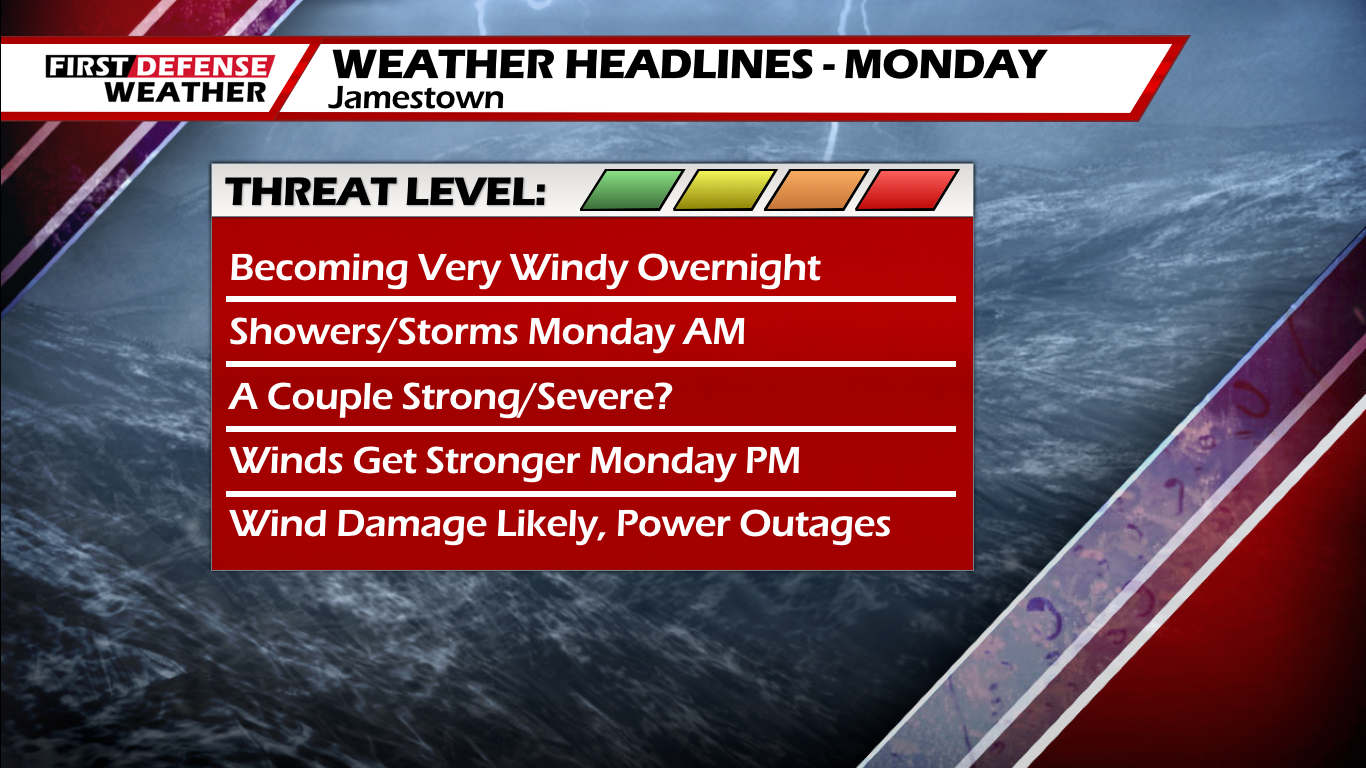
With a storm track to our northwest, the winds will really start to whip up overnight by the morning hours on Monday. In response to this, the National Weather Service has issued a High Wind Warning for Chautauqua County and points northward, starting at 5 a.m. and lasting through 11 p.m.

A High Wind Watch is in effect for the remainder of Western New York and we expect those to be upgraded to a Wind Advisory or High Wind Warning sometime today as well.
Moisture from the storm system will start to infiltrate into the region by around midnight tonight. Rain showers will be likely overnight with possibly a couple rumbles of thunder as a Warm front pushes through, rising temperatures by the morning.

We will also start to see the winds tick up as well. By the time we start the day on Monday, winds will be out of the south at 15 to 30 MPH and gusting upwards of 40 to 50 MPH.

Showers and a few thunderstorms will be likely in the morning hours with the potential that a few of those storms could tap into those strong winds and elevate those storms to strong to severe levels.
For this reason, the NOAA Storm Prediction Center has placed much of the region under a low-end Marginal Risk (level 1/5) for severe thunderstorms tomorrow.

While winds will be the primary factor, heavy downpours at times could also be possible.
Highs tomorrow will likely occur before midday as a strong Cold front will be lurking right behind and will move through in the afternoon. A morning High temp range of 57 on the hills to 65 at the Lake Erie shoreline, falling to 42 to 47 by the end of the day.
This Cold front will bring an end to the shower and storm activity but guidance continues to show the frontal passage as the focal point for the strongest winds. Winds will increase to 30 to 45 MPH with gusts likely exceeding 60 MPH at times during the second half of the afternoon.
One key thing to watch during this time will be cloud cover in association with the frontal passage. Some data has been suggesting portions of the Southern Tier may clear out into a good deal of sunshine in the late afternoon, which could further increase the risk for destructive gusts upwards of 70 MPH.
It will stay quite windy Monday night as gusts could still reach 50 to 60 MPH, before diminishing slightly overnight. We will stay windy on Tuesday with gusts still around 40 MPH at times.
There is a high likelihood of widespread wind damage throughout this period. Power outages will be likely along with the potential for tree and property damage. Make sure you secure or bring in any loose outdoor items. One thing to remember is winds of this magnitude are comparable to a small tornado and can often produce similar amounts of damage.
WNYNewsNow is a proud Ambassador for the NOAA Weather-Ready Nation program.
![]()


Leave a Reply