App users, tap here to watch video.
JAMESTOWN – We might be into spring but ol’ man Winter has a little bit to say on that subject as March-like temperatures continue throughout the week with some windows for accumulating snow at times.
Through the afternoon, there will be a few rain and snow showers in spots, otherwise mostly cloudy to overcast. Temps are well below average; 37 on the highest hills to 44 at the Lake Erie shoreline. West wind 10 to 15 MPH.
Snow showers will redevelop tonight; Accumulations of less than an inch along the the lower elevation to an inch on the hills of the Southern Tier. Another cold night. Lows 23 valleys, 31 lakeshore.
A few rain and snow showers in the morning on Thursday with some partial clearing in the afternoon. Remaining very cold. Highs 32 to 39.
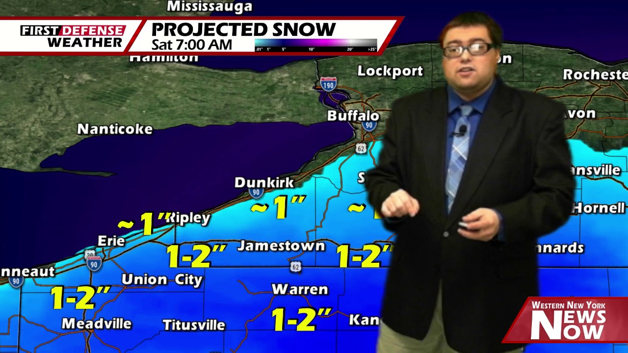
Another storm system will move to our south Thursday night and Friday, opening the window for a better chance of accumulating snow across the region. As we’ll be on the northern side of this low, some wet snow will be possible from time to time during this period.

As it stand now, accumulations will be minor with most areas picking up about an inch of fresh wet snow with upwards to 2 inches, localized total to 3 inches, on the hills and further south near the storm center.

While there still does remain a little disagreement with the prime global forecast models, the American GFS and the European Ensembles, these forecast totals are subject to change as we continue to get new data in.
While we will see some partial sunshine at times on Saturday, we will stay refrigerated with highs in the mid 40’s.

A brief return of some milder weather will return on Sunday with a few rain showers in the afternoon. Highs in the mid 50’s.
Another upper-level trough will dig into the Northeast early week bringing colder air back into the areas once again. Highs will fall into the mid to upper 40’s both Monday and Tuesday.
WNYNewsNow is a proud Ambassador for the NOAA Weather-Ready Nation program.
![]()


Leave a Reply