App users, tap here to watch video
JAMESTOWN – It’s finally feeling like spring out there today but some more rain and wind is on its way to the region once again before turning much colder next week.
The National Weather Service has issued a Wind Advisory for Chautauqua County, going into effect at 5 p.m. this afternoon and running through 6 a.m. Thursday. Wind gusts could reach up to 50 MPH with some isolated power outages possible.

Through the rest of today, expect mostly cloudy to overcast skies. There could be a few breaks in the cloud cover this afternoon along with a spotty to isolated sprinkle. The breeze will start to pick up with gusts possibly up to 40 MPH by the end of the day. Very warm. Highs 60 on the highest hills to 71 near the Lake Erie shoreline.
As a storm system back to west stalls out over Michigan, several waves of rain will be pushed through Western New York over the next couple of days. Rain will start to infiltrate the region later this afternoon into tonight. The winds will also come up overnight as well with gusts possibly up to 50 MPH at times. Very mild. Lows 54 valleys, 57 lakeshore.
Rain will continue throughout the day on Thursday with some moderate downpours at times. It will remain breezy while feeling a bit humid. Highs 58 to 65.
The rain will become a little more scattered Thursday night and Friday as the low finally regains speed and moves away from the region. In the wake of that, cooler air will be brought in on the backside of the storm, dropping ours highs into the lower 50’s for most.
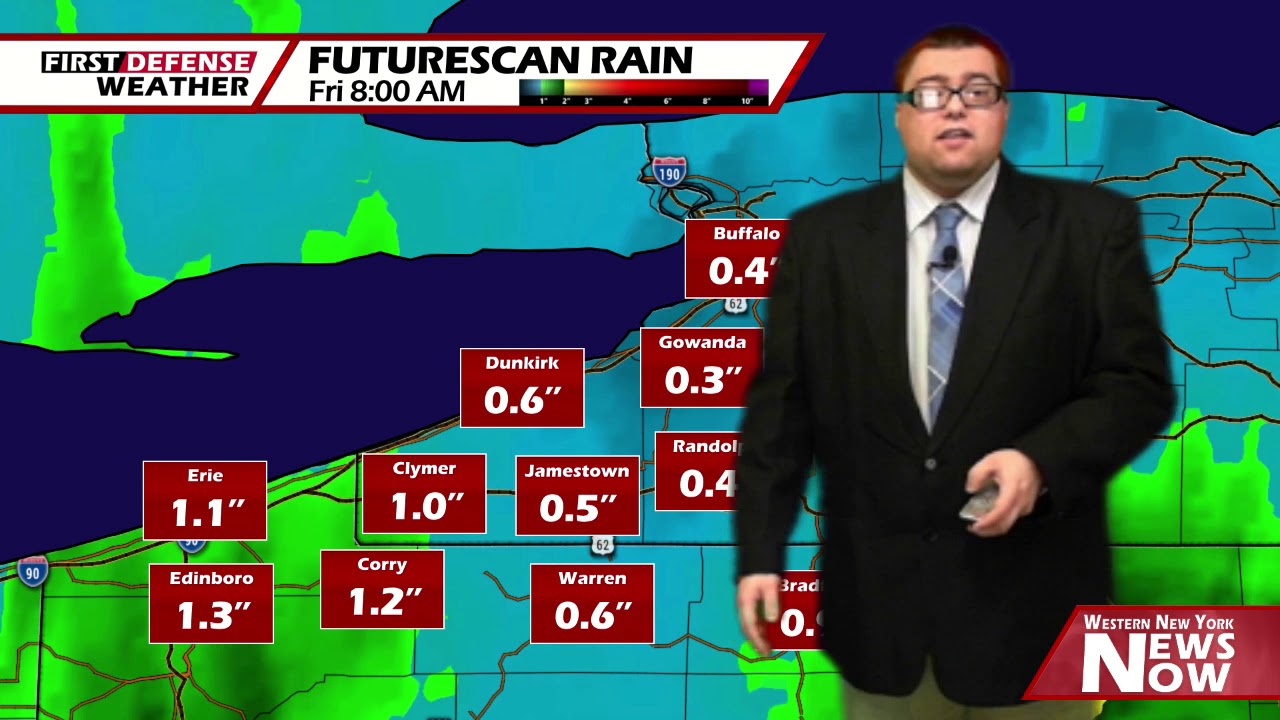
Excessive rainfall could also become another story. Throughout this stretch, we are expecting about an inch to an inch and half of rainfall across the region.

While major flooding will not be an issue, the concern will be riverbank and low-lying flooding as some local waterways could be pushed to just over crest stage.
We will sneak out a nice and dry day on Saturday with highs nearing 60.

While Sunday will be much milder, there is the chance for a few scattered afternoon showers thanks to an approaching Cold front.
Colder settles back into the area once again as temperatures return below-average through mid next week.
WNYNewsNow is a proud Ambassador for the NOAA Weather-Ready Nation program.
![]()


Leave a Reply