App users, tap here to watch video
JAMESTOWN – After a very typical springtime weekend, Mother Nature continues her cruel joke of colder air across the region this week. Areas of frost will be likely tonight before the sun comes back on Tuesday.
The National Weather Service in Buffalo has issued a Freeze Warning for Chautauqua County and points northward, going into effect at 1 a.m. tonight and running through 9 a.m. Tuesday morning.

Through the reminder of today, clouds will be the story with possibly some limited peaks of sunshine late in the day. Highs 46 on the hills to 52 near the Lake Erie shoreline. There will be a stiff northwest breeze 10 to 20 MPH through the afternoon.
As the cloud cover starts to decrease tonight, we will be left with partly cloudy skies through the overnight. This will not only be prime for temperatures to slip back quite a bit by morning, but areas of frost will develop after midnight.
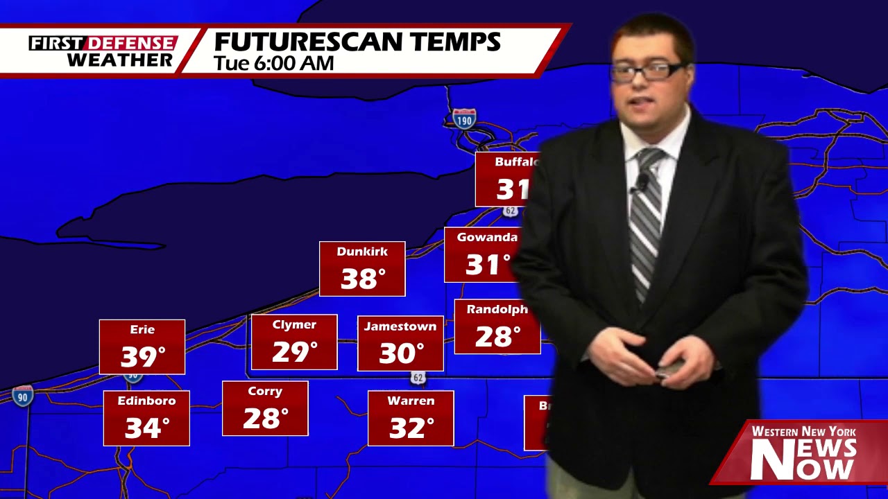
As noted by forecast temperatures coming off of the in-house computer model, inland areas will drop sub-freezing by sunrise tomorrow morning while the lakeshore areas will remain above freezing, reducing the risk for frost development. We’ll keep our morning low range at 27 to 38.

Make sure you protect any sensitive outdoor vegetation by covering them up or bringing them inside if possible. As seasoned planters know, frost can damage or even kill crops and plants that are delicate to freezing temperatures.
After morning frost burns off, we will be left will good amount of sunshine for the afternoon. Stays chilly with highs 47 to 54.
A weak surface low morning south of the region on Wednesday will become the focal point for a couple scattered showers throughout the day. We stay cold with highs in the upper 40’s.
As a Cold front approaches, we should be in the lower 50’s on Thursday before the passage of the front with a couple rain showers from time to time.
As that front sweeps through, much colder air will be dragged back into the region once again. Highs will fall into the upper 30’s to lower 40’s with some rain and snow showers possible Thursday through Sunday. We are still way too far out to know if any accumulation will be possible.

One of the things will have to keep an eye on is ground temperatures in relation to air temperature. The colder the ground, the better chances there are for the snow to stick.
WNYNewsNow is a proud Ambassador for the NOAA Weather-Ready Nation program.
![]()


Leave a Reply