App users, tap here to watch video
JAMESTOWN – Another dry but chilly afternoon is ahead but a big pattern flip will take shape later in the week, equating out to March-like air invading the region by the weekend.
While there will be more clouds than sun today, some peaks of sunshine are indeed possible. It will remain chilly through the day. Highs will range 46 on the hills to 51 lower elevations.
Mostly cloudy and rather quiet tonight. Thanks to a storm system squeaking by to the south, there will be a small chance for a spotty rain or snow shower down near the New York/Pennsylvania line overnight. Lows 33 valleys, 39 lakeshore. Light wind.
A mix of sun and clouds will take us through much of the day on Wednesday with highs 43 to 48.
A weak boundary in association with a Cold front will become the focal point for a few rain showers through the day on Thursday with highs in the lower 50’s.
As the Cold front sweeps through later Thursday, arctic air will be dragged back into the region with north wind flow aloft. Highs on Friday will drop into the lower 40’s at best with a few rain and snow showers possible throughout the day.
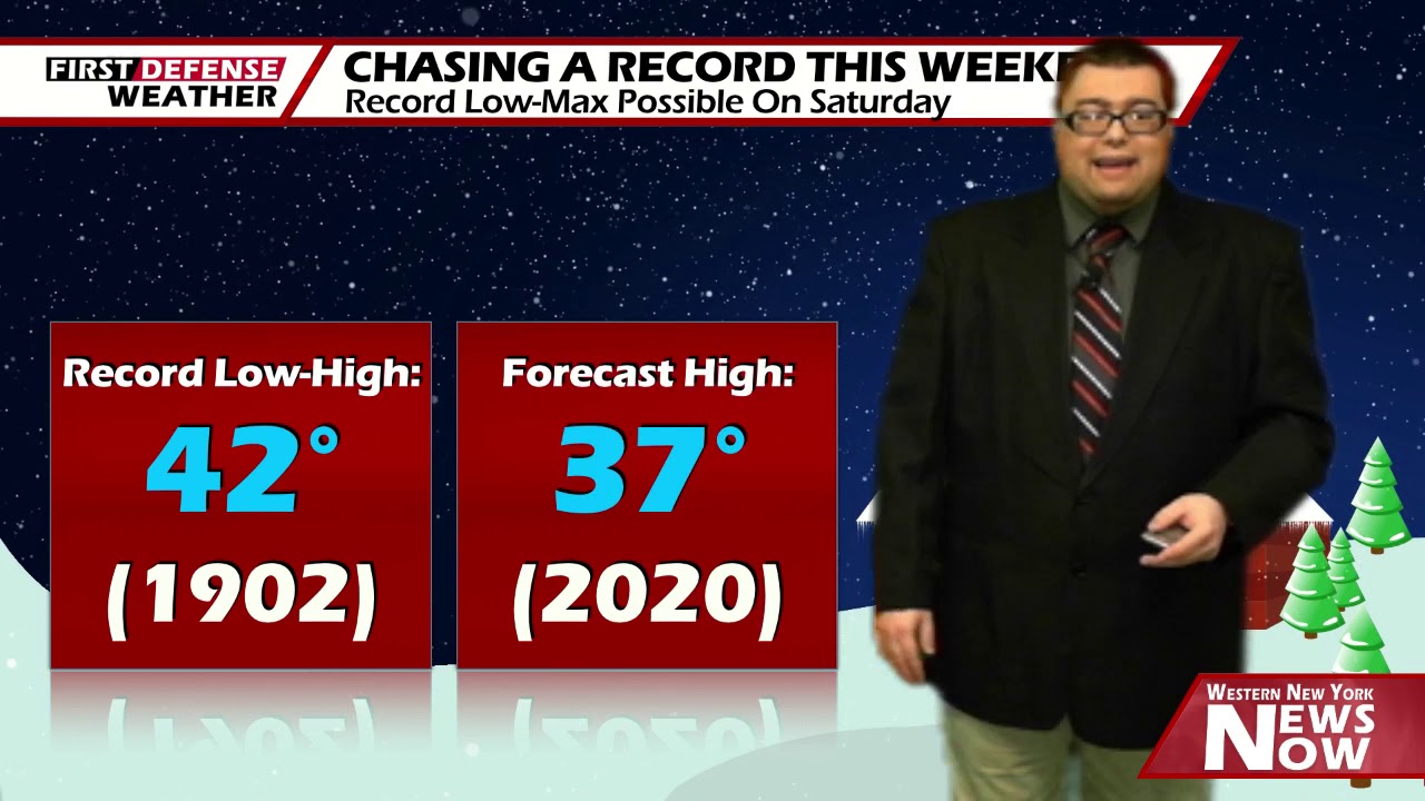
As the cold air continues to filter in, we could be setting a record come Saturday. The lowest observed high temperature for May 9 in Jamestown is 42 degrees, set way back in 1902. We are forecasting 37. Should that verify, we will have the coldest high temperature ever for the ninth of May, breaking a record that has stood for over 100 years.

Mother’s Day will be quite chilly with a limited chance for a spotty rain or snow shower. Highs in the mid 40’s.

We’ll keep a chance for a few rain and snow showers on Monday with highs in the upper 40’s.
WNYNewsNow is a proud Ambassador for the NOAA Weather-Ready Nation program.
![]()


Leave a Reply