App users, tap here to watch video
JAMESTOWN – Winter will not release its grip quite yet as very cold air moves into the region overnight producing some snow showers through Mother’s Day weekend. However some things might be changing for the better down the road.
The National Weather Service has issued a Freeze Warning for Chautauqua County, effective 8 p.m. tonight until 11 a.m. Saturday morning.

As temperatures drop into the 20’s for most areas tonight, freeze conditions will likely harm or kill any sensitive vegetation that are left outdoors or uncovered.
Through the afternoon, clouds will be story with a few rain and snow showers at times. It will be quite chilly. Highs will range 37 on the hills to 43 near the Lake Erie shoreline. Northwest wind 9 to 17 MPH.
Snow showers will persist overnight tonight with partly to mostly cloudy intervals. Little to no snow accumulation is expected. Very cold. Lows 24 valleys, 32 lakeshore.
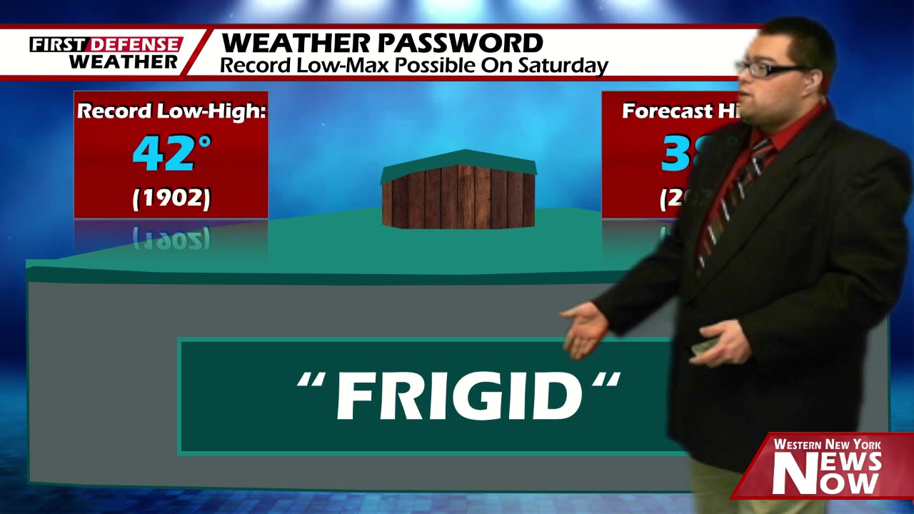
As we’ve been talking about all week long, Saturday will be just a down-right frigid day. If we hit our forecast high of 38, that will be the coldest May 9 in Jamestown since 1902 where the high was only 42, officially busting that 118-year-old record low maximum high.

On again, off again snow squalls will continue through the day on Saturday with minimal accumulations due to warmer ground temperatures helping to melt some of the snow as it hits the surface. However, accumulations of a half inch or less on the lower elevations to upwards of an inch are possible along the higher elevations.
Mother’s Day will be quite chilly with a few rain and snow showers at times with mostly cloudy intervals. Highs in the upper 40’s.
We will stay cold on Monday with rain and snow showers likely through the day. Highs in the lower 40’s.
Heading into the middle of next week, we do see the upper air pattern shifting with the Jet Stream pulling north. That will allow warmer southerly air to surge into the northeast with an area of high pressure.

Temperatures will slowly climb through the 50’s and lower 60’s by next Thursday with only a small chance for a shower in the afternoon.
WNYNewsNow is a proud Ambassador for the NOAA Weather-Ready Nation program.
![]()


Leave a Reply