App users, tap here to watch video
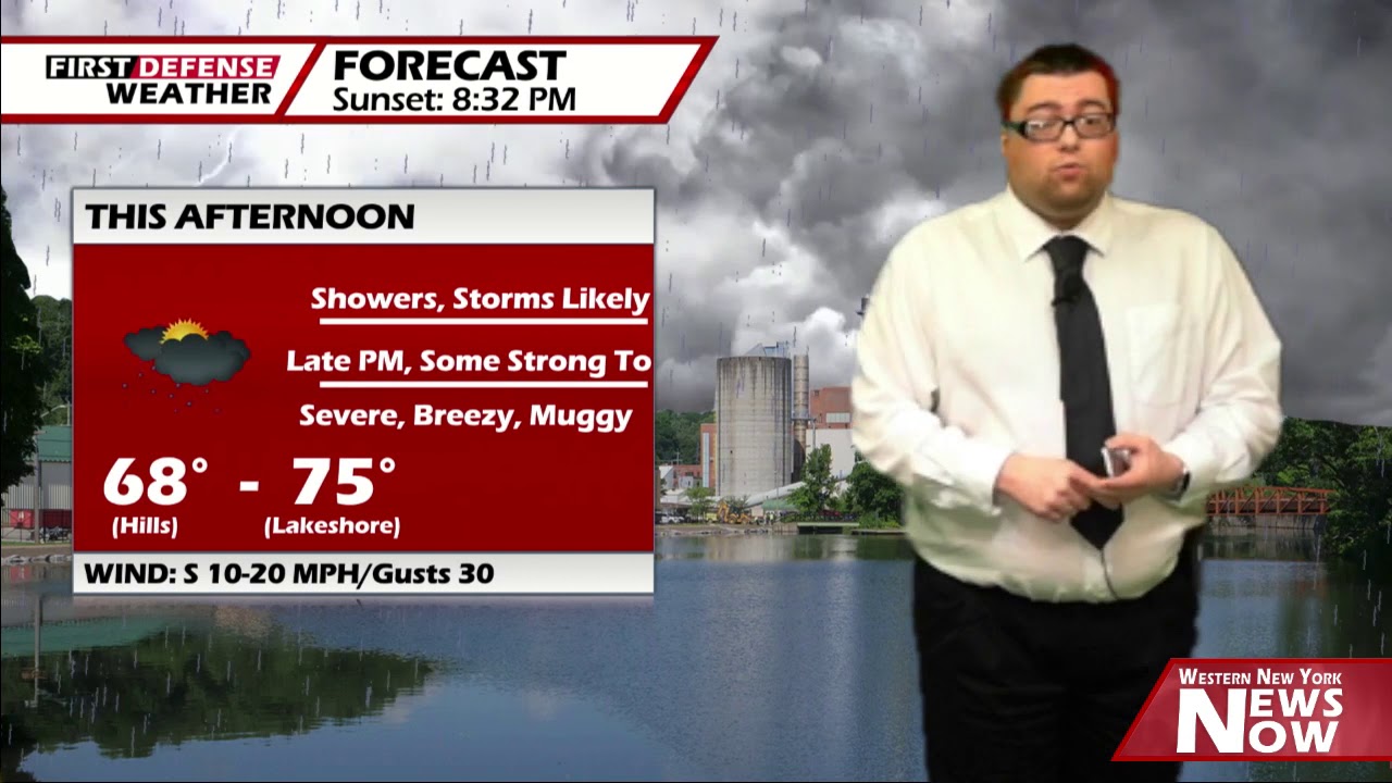
JAMESTOWN – We’re gearing up for an active weather day as showers and thunderstorms will blossom this afternoon with some of them potentially becoming severe with strong winds and large hail.
The NOAA Storm Prediction Center has outlined all of the Southern Tier and Northwestern Pennsylvania under a standard Slight Risk, a level 2 out of 5, for severe thunderstorms this afternoon.

As a squall line of showers and thunderstorms flair out ahead of a Cold front, and move through the western-most areas by around 1 to 2 pm., the Southern Tier by 2 to 4 p.m.

Given the atmospheric conditions that are in play, strong wind gusts of 60 MPH, large hail up quarter size, and heavy rainfall will be the primary threats with these storms. However, there is a small chance for an isolated tornado as well.
While flash flooding is not expected, some low-lying flooding could be possible from excessive rainfall with models suggesting the Southern Tier will pick up around an inch of rain today and tonight.
It will be a very mild and somewhat muggy day. Highs 68 on the hills to 75 near the Lake Erie shoreline. South winds 10 to 20 MPH with gusts up to 30 MPH at times.
Make sure you have a way of getting watches and warning this afternoon if and should they be issued.
WNYNewsNow is a proud Ambassador for the NOAA Weather-Ready Nation program.
![]()


Leave a Reply