App users, tap here to watch video
JAMESTOWN – It’s a different day but the weather isn’t changing. Showers and thunderstorms will continue to pop up in random spots through the next couple of days before we turn down the heat and the humidity for later this week.
The NOAA Storm Prediction Center has placed much of the Southern Tier under a low-end Marginal Risk, a level 1 out of 5, for severe thunderstorms this afternoon.

While the overall threat for severe activity is rather low with these pop-up storms, there is the chance a couple of them could be strong to severe with gusty winds and maybe some small hail.
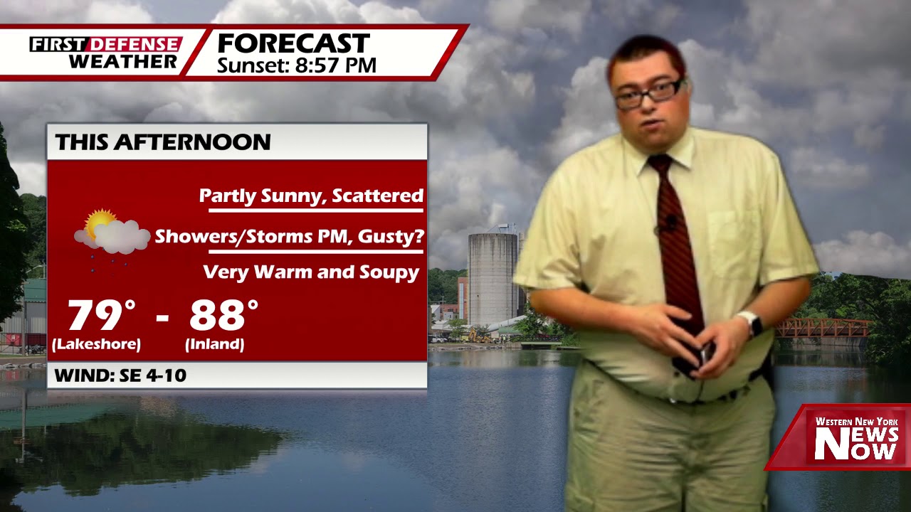
It will also still be very warm and humid. Highs 79 at the immediate Lake Erie shoreline to 88 well inland.
After early showers and storms settle down, the reminder of the night should be mostly cloudy but we will keep the chance for an isolated storm overnight. Warm and muggy. Lows 63 valleys, 68 lakeshore.
A deep storm system arrives Tuesday producing showers and thunderstorms across the region. This will be the best chance to see an areal-wide rainfall which could knock a ding into our rainfall deficit, which is currently running over two inches below normal. Highs in the lower 80’s.
An area of high pressure will build in for Wednesday and Thursday bringing drier, cooler and less humid weather to the region. Highs in the mid 70’s.

Due to the weakness of that high, it will be quickly pushed out on Friday allowing a warm front with another storm system to cross into Great Lakes bring back the humidity and scattered storms once again.
The weekend, as of now, is looking rather mild and wet with numerous showers and thunderstorms each day and highs in the lower 80’s.
WNYNewsNow is a proud Ambassador for the NOAA Weather-Ready Nation program.
![]()


Leave a Reply