App users, tap here to watch video
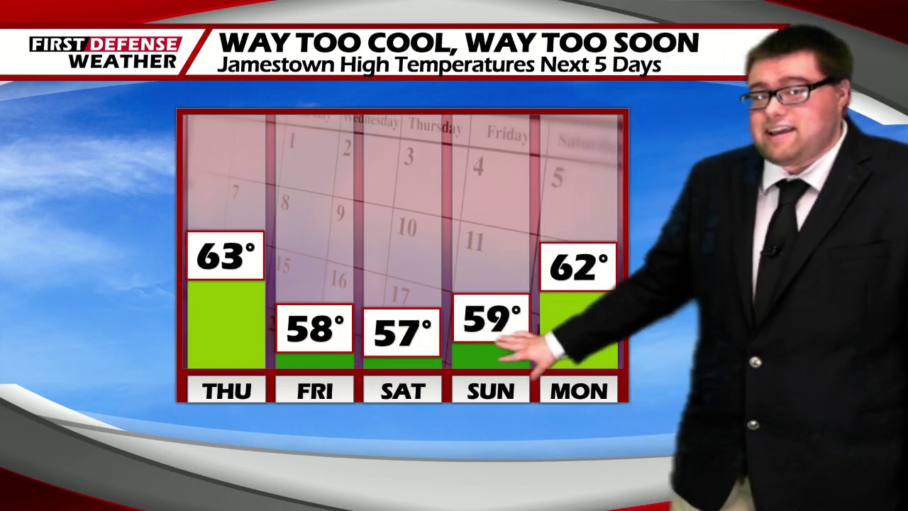
JAMESTOWN – More fall-like air will be surging in on Friday and will stay with us throughout the weekend with some sunshine to make it look and feel warmer.
A weak Cold front has swept through which will keep us rather chilly for this time of the year. We could be close to breaking record low temperatures around the region over the weekend.
Clouds will be with us through the evening which will start to break apart overnight. Lows 40 in the valleys, 51 at the Lake Erie shoreline.
Lots of sunshine will take through the day on Friday but temperatures will be held down well below average. Highs 55 to 64.
Some morning frost will burn off in the morning on Saturday with a chilly sun holding strong. Highs in the upper 50’s.

Sunshine and fall temperatures will take us through the second half of the weekend into early next week. Temps will marginally warm up into the mid 60’s by Tuesday with highs going into the lower 70’s on Wednesday.
WNYNewsNow is a proud Ambassador for the NOAA Weather-Ready Nation program.
![]()


Leave a Reply