App users, tap here to watch video
JAMESTOWN – Lake Erie has come alive and will produce some lake effect rain showers over the next couple of days with true fall-like air locked and loaded through the rest of the week.
After the passage of a front, much cooler air has been surging in across the relatively warmer waters of Lake Erie which has become the focal point for some lake effect rain to develop off the southeastern end of the lake. We’ll keep the cool air in place throughout much of this week.
Scattered to widespread showers will continue tonight. Winds will diminish after midnight. Lows 44 in the valleys, 53 at the Lake Erie shoreline.
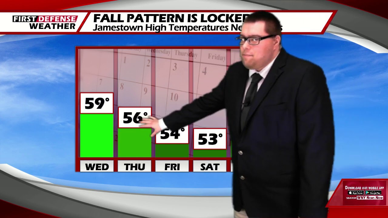
As we kick off October on Thursday, we’ll be ringing it in in typical fall-time fashion. Scattered rain showers with highs 54 to 60.
As a trough digs into the region throughout the rest of the week, highs will go down into the lower 50’s with lows dropping into the mid to upper 30’s. Some frost will be possible inland away from the lakeshores Saturday and Sunday morning.

We should stay mainly dry on Monday and Tuesday of next week with highs still remaining below average in the upper 50’s to lower 60’s.
WNYNewsNow is a proud Ambassador for the NOAA Weather-Ready Nation program.
![]()


Leave a Reply