JAMESTOWN – Confidence is increasing in a winter storm that could have major impacts to the region over the weekend.
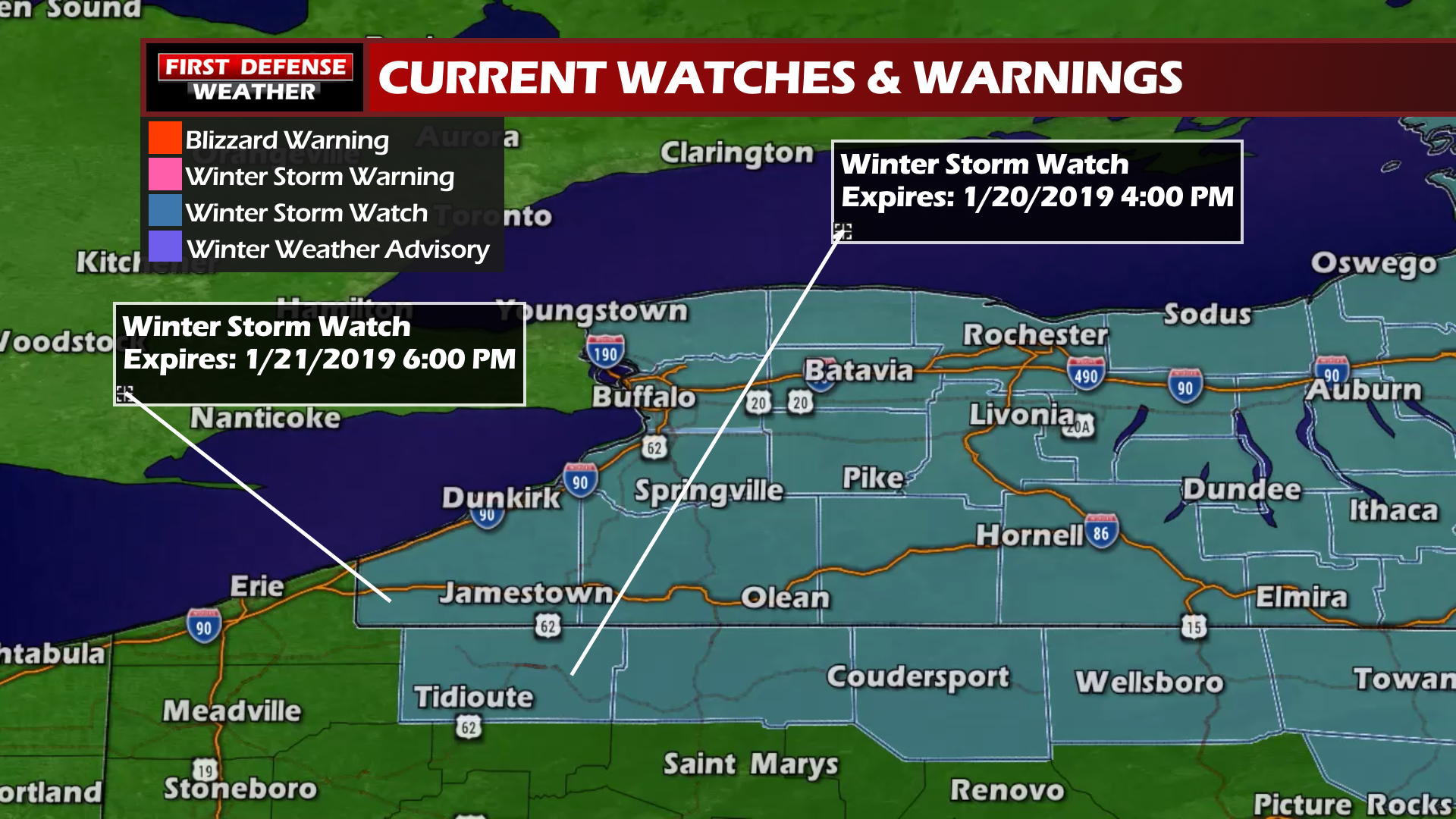
The National Weather Service has posted up a Winter Storm Watch for all of Western New York, going into effect at 1:00 PM Saturday until 1:00 PM Monday for potentially heavy snow, sub-zero wind chills and blowing snow.

First off for today, a rather quiet Thursday. A weak frontal boundary will approach tonight trigging off a few snow showers for Friday. Not expecting a big deal out of that, possibly a couple inches at most.
As have been the case throughout the week, we are continuing to keep our eyes on a winter storm will move through the Northeast this weekend.
Snow will start on Saturday and begin to tick up in intensity throughout the day. Snow will become the heaviest Saturday afternoon through Sunday with blowing and drifting snow from gusty winds. We could also add some lake effect Sunday night into Monday on on the back end of the storm as the system pulls away from the region.

While we are still somewhat uncertain on the exact track the storm could take, we have narrowed it down to two plausible ideas based on newer model guidance.
The first idea is a storm track that is closer to the region. We would be impacted by the heavier snow bands that are close to the central Low. This would also set the stage for lake effect Sunday night as strong northwest winds drive across the open waters of Lake Erie. Our “Snow Machine” algorithm is favoring this idea with snow totals over 12″, possibly even approaching two feet in some spots.

Idea number two is a track further away from the region. This would mean less snow and a more limited chance for lake effect. One of our FutureScan models is playing with this idea, showing significantly lower totals across the area.

Any jog in the storm track will change all of this, even as much a 50 to 100 miles. North, more snow. South, less snow. No matter what happens here, it will be down-right cold over this 72-hour stretch. Temps will struggle to hit double digits Sunday and Monday with hard wind chill values.

We will keep you updated with all the latest as we continue to examine the newest data.
WNYNewsNow is a proud Ambassador for the NOAA Weather-Ready Nation program.
![]()


Leave a Reply