JAMESTOWN – After coming off a high of 57 degrees on Monday, things are cooling off for the next couple of days.
The Areal Flood Watch remains in effect until 1 AM Thursday for Chautauqua and Cattaraugus Counties. The potential still does exist for some flooding relating to ice jams and the snow and ice packs continue to melt.

A Cold front moved on through earlier which is dropping temperatures through the 30s this afternoon as winds have shifted to the Northwest.
Behind this front, a weak weather system will move though tonight and tomorrow, bring some more rain showers overnight tonight.
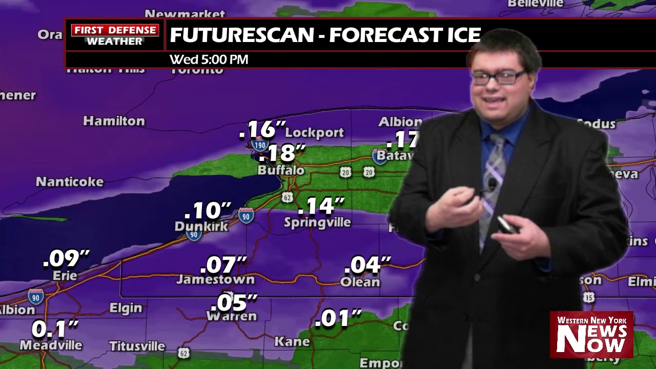
As temps will hover around freezing early on Wednesday, there is the potential for some freezing rain during the morning hours. Understand, not everyone will see icing. Those who will stay above freezing will see a plain cold rain.

Any ice accumulation will be little, enough to cause some slick spots on untreated roads and surfaces, but not enough to cause a major problem.
We will have one more day of 50+ on Thursday as a Warm front comes through before more colder air works in for the weekend and early next week.

WNYNewsNow is a proud Ambassador for the NOAA Weather-Ready Nation program.


Leave a Reply