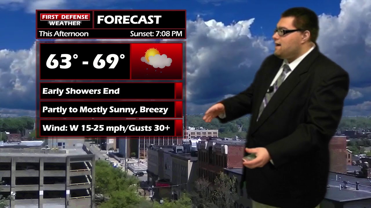
JAMESTOWN – A Cold front sweeping through will keep temperatures in the mid to upper 60’s through the day. Clouds will break apart leading to a mostly sunny afternoon, lasting through Friday.
With an average wind around 10 to 20 MPH this afternoon, wind gusts could reach up to 30 MPH at times. Highs will range 63 on the hills to 69 lower elevations.
Any clouds around will break this evening, leading to a mainly clear night tonight. Some patchy river valley fog will develop by morning. Lows 44 to 54.
A mostly sunny day is coming up for Friday with highs 68 to 75.
Friday night, the Jamestown Red Raiders will be on the road to Clarance to take on the the Clarance Red Devils. Temperature around 72 at kickoff, down to 67 by the fourth quarter with mainly fair skies.

Late night on Friday, some showers and thundershowers will develop along a front. Those showers will continue into the day on Saturday with highs in the mid to upper 70’s.
Sunday will be the better of the two weekend days with partial sunshine and highs in the mid to upper 60’s.

We return to above average temperatures next week with highs in the upper 70’s. We have a good shot of either tying for breaking the record high for October 1st, which is 81 set back in 1988.
WNYNewsNow is a proud Ambassador for the NOAA Weather-Ready Nation program.
![]()


Leave a Reply