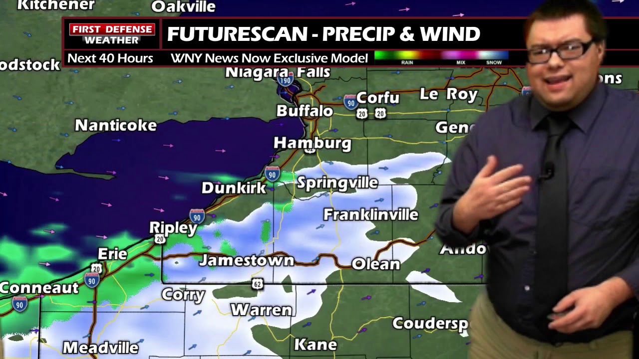
JAMESTOWN – The winds will continue to ramp up through the day with showers and possibly a thunderstorm this afternoon. Temperatures will drop later this afternoon as a Cold front moves through, changing all the rain to snow for the nighttime hours, lasting through Thanksgiving Day.
The National Weather Service maintains the High Wind Warning for much of Western New York until 1 a.m. Thursday morning. A Wind Advisory remains in place through early Thursday for the reminder of the region and Northwestern Pennsylvania.

There is also a Winter Weather Advisory for accumulating snow in effect for Warren County, PA, going into effect at 7 p.m. this evening and running through 10 a.m Thursday.

A deep area of Low pressure currently stationed over Lake Michigan is our current weather maker. With the Low passing to our northwest, that provides the prime environment for strong gusty winds across the area. Winds gusts could reach upward of 50 MPH at times through tonight.
High temperatures for the day have already occurred as a Warm front attached to the system moved through this morning. Following right behind it is that Cold front and temps will drop from west to east as the front marches closer and sweeps through.

With colder air filtering into the region, rain will transition to snow tonight and lasting through early Thursday. While snow accumulations will be light, some spots mainly along the hills of the Southern Tier could see an inch or two, with as much as 4 or 5 inches in the hills of Warren County. Lows 34 to 38 with wind gusts near 50 MPH times.
Thanksgiving day will start rather breezy with gusts upwards of 40 MPH early, along with rain and snow showers through early afternoon. Precipitation will come to an end for the later afternoon and evening with cloudy skies. Temps nearly stationary between 35 and 40.

Black Friday is looking good for all of those shopping deals with partial sunshine and highs in the upper 30’s.
There maybe a few snow showers on Saturday, otherwise partly sunny with highs in the upper 30’s.
As we start December on Sunday, another storm system will likely be scooting by to our south. Temperatures will likely start in the lower to mid 40’s with widespread rain showers through the day. Depending on the exact track of the storm, temperatures could hover at or just below freezing Sunday night into early Monday. Current model guidance is suggesting that idea with some pockets of freezing rain during that period.
The factors that could have an impact on this forecast are how close the center of the storm passes to the region and how much sleet could mix in. If there is more sleet, that will likely hold down potential ice accumulations, which will likely be minor in nature to begin with, based on forecast upper air data.

We turn much colder again on Tuesday with a few snow showers and temps barley making it to the lower 30’s.
WNYNewsNow is a proud Ambassador for the NOAA Weather-Ready Nation program.
![]()


Leave a Reply