App users, tap here to watch video
JAMESTOWN – The stretch of dry and cooler weather is coming to an end with the chance for showers and thunderstorms on Thursday that could be on the stronger side.
High pressure is starting to scoot on out off the Atlantic east coast which will allow for our next storm system to come our way on Thursday with temperatures warming up through the weekend.
If you have the opportunity to see the Neowise Comet tonight, I highly suggest that you do. The comet will be visible in the northwestern sky just about an hour after sunset tonight (8:51 p.m.). It will be a great night for viewing as well. Mainly clear skies but mild. Lows 62 in the valleys, 71 at the Lake Erie shoreline.
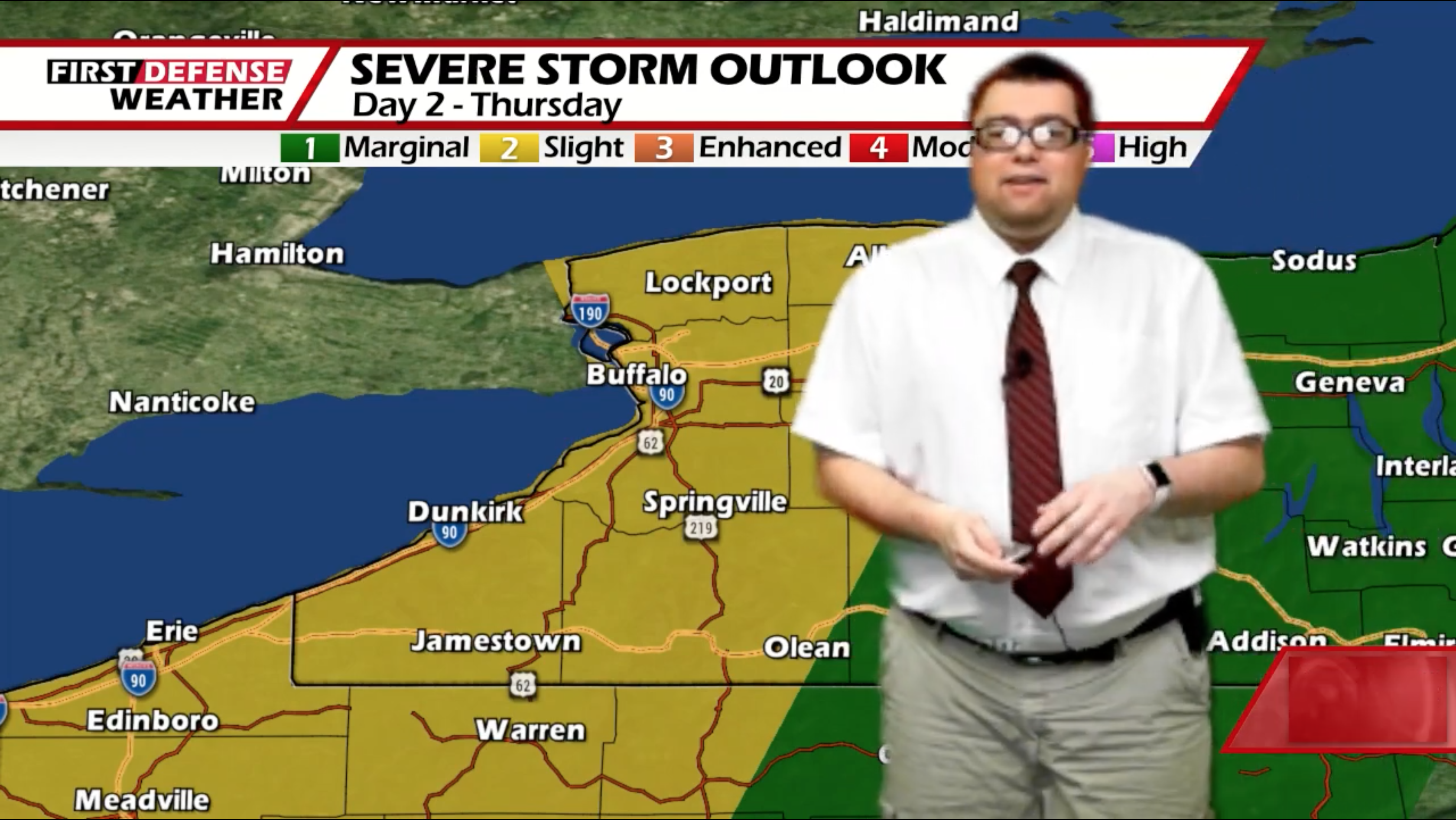
The NOAA Storm Prediction Center has placed all of Western New York and Northwestern Pennsylvania under a standard Slight Risk, level 2 out of 5, for severe thunderstorms Thursday afternoon with a low-end Marginal Risk, level 1 out of 5, further out to the east.

As a storm system moves close to the region, numerous showers and storms will be possible in the afternoon. Some of them could contain damaging winds, large hail and heavy rain with the main timing likely between 1 and 5 p.m.

While not a primary factor, there could be an isolated spin-up tornado as well. The overall threat for torantic activity is rather low but it is worth mentioning. Highs 77 to 86.
A few leftover showers and storms are possible on Friday with partial clearing. Highs in the lower 80’s.
The humidity really starts to become much more notice over the weekend. While Saturday should be many dry with a good supply of sunshine, the humidity will be creating a a sticky heat index once again. Highs in the upper 80’s.

Wide-spaced popup showers and thunderstorms makes a return during the second half of the weekend into early next week. Highs will be in the upper 80s to near 90 each day with heat indices likely reaching the lower to mid 90’s once again.
WNYNewsNow is a proud Ambassador for the NOAA Weather-Ready Nation program.
![]()


Leave a Reply