App users, tap here to watch video
JAMESTOWN – Fall weather will continue in nature over the next couple of days with some summer warmth making a return over the weekend.
A high pressure ridge that has slid in from the north after the passage of a cold front which will lead us to a few more days of sunny and dry weather. As the wind flow aloft shifts back to the south later in the week, warmer air will be surging back in once again.
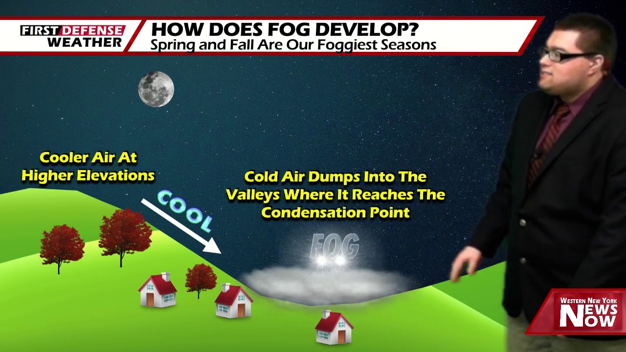
Mainly clear skies will take us through tonight with some areas of patchy fog developing after midnight. Very crisp. Lows 46 in the valleys to 56 at the Lake Erie Shoreline. Light winds.
Sunshine will continue into Thursday while remain comfortable. Highs 73 to 83.
With warmer air coming in for Friday, highs will soar into the lower 80’s with a great supply of sunshine.
We should stay dry on Saturday with highs still in the lower 80’s.

We will introduce the chance for a few showers Sunday through Tuesday with highs nearing the 80 degree mark. While neither day will be a total washout, you will be dodging a few raindrops from time to time.
WNYNewsNow is a proud Ambassador for the NOAA Weather-Ready Nation program.
![]()


Leave a Reply