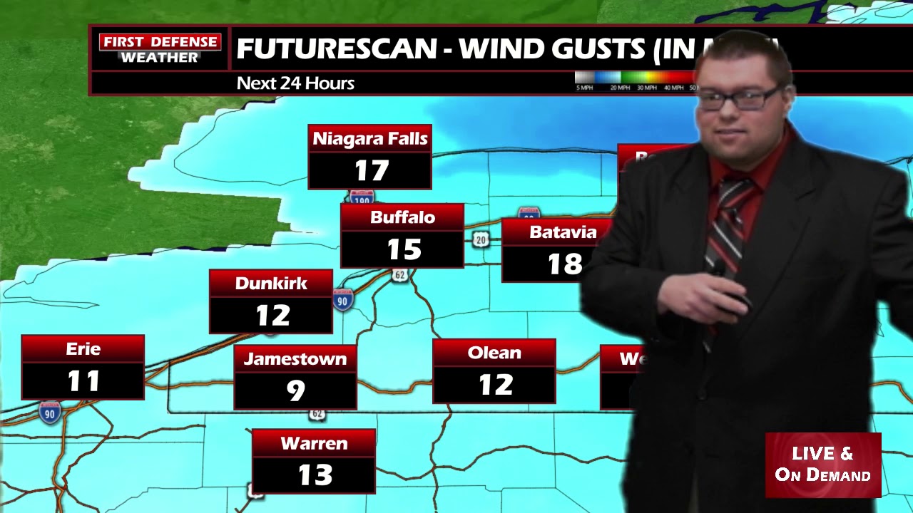
JAMESTOWN – Temperatures have been going the wrong direction throughout the day as a Cold front has swept on by, bringing some stronger wind gusts along with it as well.
The National Weather Service maintains the Wind Advisory for Chautauqua County until 7 PM this evening. While the strongest winds are over, some gusts near 40 MPH are still possible.


The winds will die down tomorrow; 4 to 8 MPH out of the Northwest by the afternoon.

While today will be mainly a mostly cloudy day, the chance does exist for a light snow flurry. That chance is rather minimal, however. Most computer model guidance has been depicting a weak band of lake effect effect setting up tonight, lasing through the morning hours on Saturday. Not expecting much the way of accumulation out of that.
We will get back into the 30s for next week which will be right around the averages for this time of the year. We are still keeping our eyes on mid to late week next week as a storm system will likely ride across the Northeast. It is still way too early to know the exact track the system will take and what kinds of impacts we could see out of it.

WNYNewsNow is a proud Ambassador for the NOAA Weather-Ready Nation program.


Leave a Reply