JAMESTOWN – Things are starting to simmer down in the weather department for the next couple of days as High pressure is building in. However, a deep storm system will come up through the Great Lakes late in the weekend and produce strong to damaging winds Sunday.
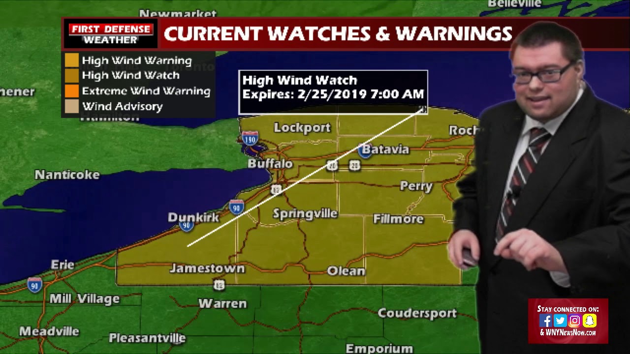
In a proactive step, the National weather Service in Buffalo has posted up a High Wind Watch for all of Western New York, going into effect at 7 AM Sunday and running through 7 AM Monday for wind gusts 60 to possibly even 70 MPH.

Winds of this magnitude could easily cause scattered power outages relating to falling tree branches or damage to power lines themselves. Minor property damage could even arise if outdoor furnishings are not brought inside or tied down.

This storm system will also bring waves of rain showers throughout the day on Sunday. While we haven’t gotten some of the high resolution computer model data in yet due to this event still being a few days out, the potential does exist for some moderate to heavy downpours, especially early on Sunday as the system churns west of the region.

This storm system will be feeding off loads of Gulf moisture with a southernly wind flow aloft. As you all know, temperatures are always boosted when the wind comes out of the south and that will certainly be the case this weekend. Most everybody will be in the 40’s Saturday and lower 50’s on Sunday. That’s a nice taste of spring!

However, as they say, all good things must come to an end. We’re right back into winter next week with temps in the 20’s and 30’s with limited chances for some snow showers.
WNYNewsNow is a proud Ambassador for the NOAA Weather-Ready Nation program.


Leave a Reply