App users, tap here to watch video.
JAMESTOWN – Mother Nature is playing an April fools joke on us 10 days late as January-like weather continues across the region this afternoon with snow showers and a bitting wind chill. We’ll be in better shape for the weekend before another storm impacts us on Monday with potentially damaging winds.
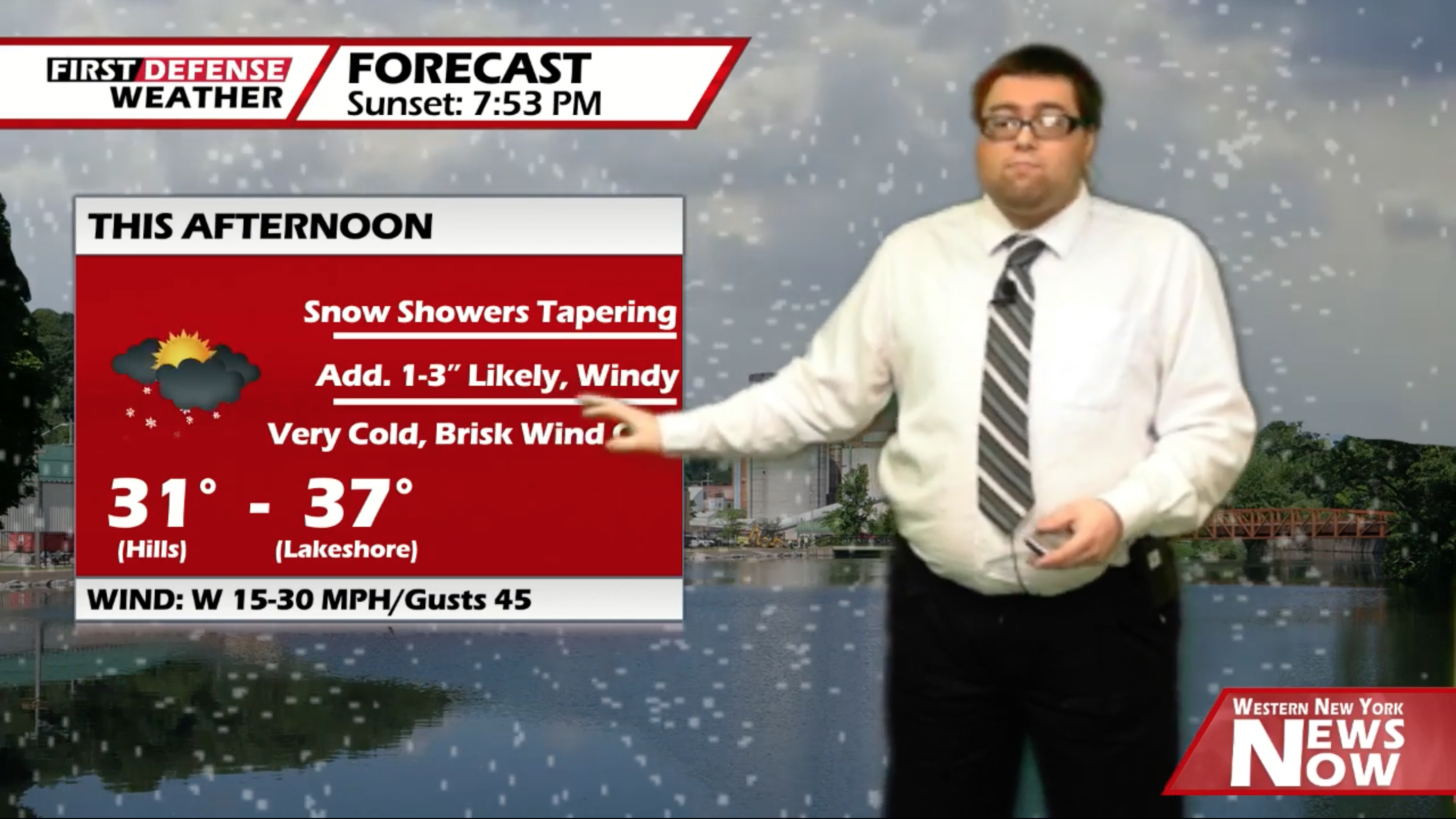
After receiving a good several inches of fresh snowfall in spots around the Southern Tier last night and this morning, the most amount of the snow has started to taper off. We will still be left with some scattered snow showers through mid afternoon. The winds will also remain up through the day with gusts possibly up to 40 MPH at times, creating a bitter wind chill index.
Any additional snowfall will be minor; about an inch or two along the lower elevations to possibly upwards of 3 inches along the highest hills of Chautauqua and Cattaraugus Counties. It will be very cold with highs 31 on the hills to 37 near the Lake Erie shoreline.

After the snow comes to an end, we will be left with partly to mostly cloudy skies for the afternoon. However, the winds will stay breezy through the night with gusts possibly up to 30 MPH. Lows 26 valleys, 33 lakeshore.
High pressure will make a brief return to the region on Saturday providing some nice sunshine. We will remain below average but much warmer than today with highs 42 to 50.
Easter Sunday will be mainly dry with some partial sunshine but a few scattered showers will be possible throughout the day. Highs will be back up to near 60.
Heading into Sunday night, a deep storm system will approach the area and move just to our west and northwest through the Upper Great Lakes. Widespread rain will influx the region with a couple rumbles of thunder possible especially on Monday with highs in the lower 60’s.

With the current model guidance showing the low associated with the storm deepening as it moves closer, this will produce a threat for damaging wind gusts throughout the day on Monday. Winds could gust reach up 60 MPH with some spots possibly reaching upwards of 70 MPH especially northeast of Lake Erie.
While no High Wind Watches or Warnings have been issued at this time by the National Weather Service, we do expect them to be issued sometime over the weekend based on current information.

Looking beyond early next week, another trough will dig into the Northeast bringing colder air back into the region once again. Scattered rain and snow showers will be possible Tuesday, Wednesday and Thursday with highs only int eh upper 30’s to lower 40’s.
WNYNewsNow is a proud Ambassador for the NOAA Weather-Ready Nation program.
![]()


Leave a Reply