App users, tap here to watch video
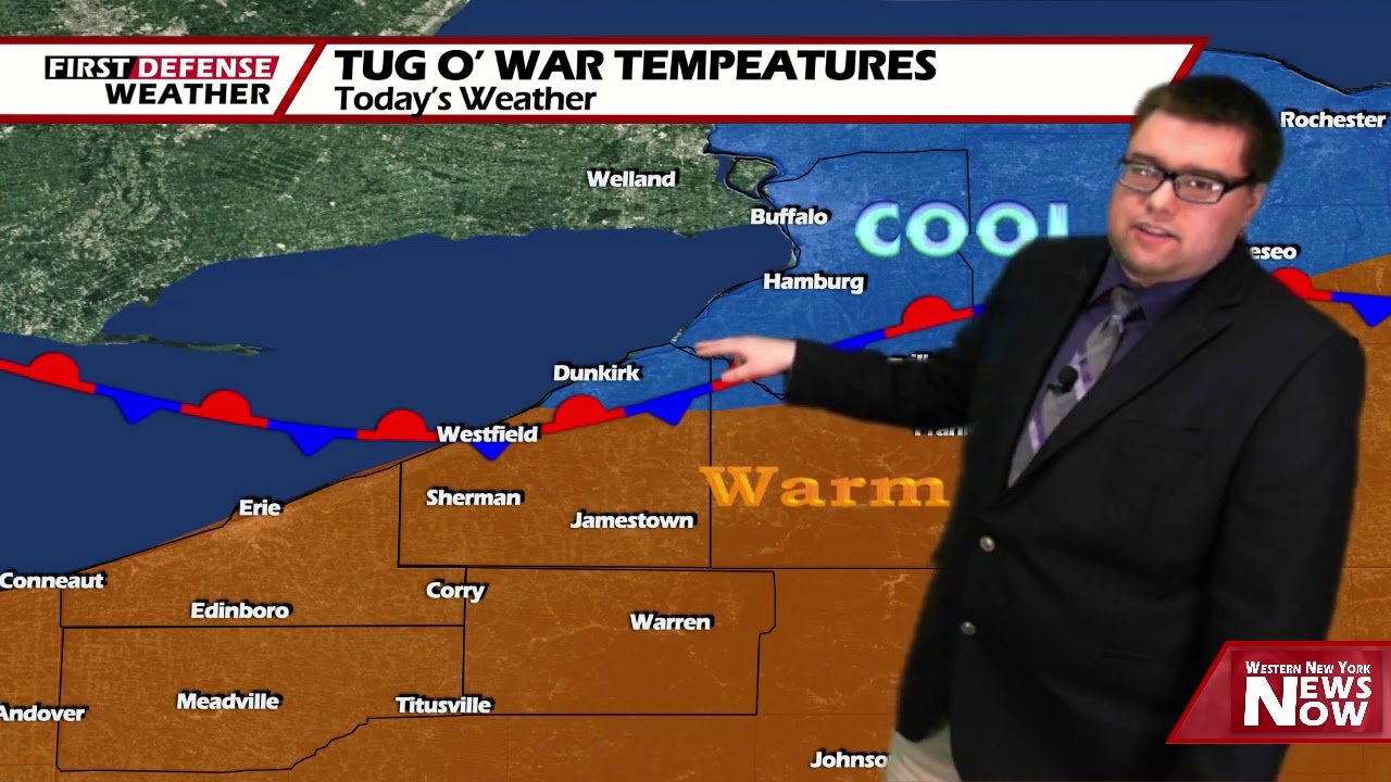
JAMESTOWN – Another day of split temperatures thanks to a stalled front will usher in an extended period of cooler, fall-like air with some rain sneaking in over the weekend.
A stationary front splitting the region has become the focal point for cooler temperatures and more clouds in the northern towns with warmer air and more sunshine to the south. The front will move south tonight and allow cooler air to invade all of the region lasting through much of the upcoming week.
Skies will clear tonight with some areas of patchy fog developing overnight. Lows 57 in the valleys, 67 at the Lake Erie shoreline. Light winds.
With the passage of the front, expect more clouds and sunshine with a small chance for spotty afternoon shower. Cooler and less humid. Highs 68 to 76.
Sunshine will be back in full force on Friday with cooler and refreshing air continuing. Highs in the lower 70’s.
Partial sunshine will take us through the day on Saturday with highs in the lower 70’s.

A storm system pulling into Great Lakes will bring us showers and thundershowers on Sunday. While the day will likely not be a total wash, rain will be prevalent. Highs in the lower 70’s.
We dry out with refreshing air making a return for both Monday and Tuesday of next week with the sun back in full force.
WNYNewsNow is a proud Ambassador for the NOAA Weather-Ready Nation program.
![]()


Leave a Reply