JAMESTOWN – Area-wide snow is starting to taper off this afternoon but another storm system is on its way to the region.
The National Weather Service has canceled the Winter Weather Advisory for all of Western New York. The snow has started to wind down in intensity and thus no longer requires the advisory to be active.
We’ll get a break from the snow tomorrow with mostly cloudy skies. A storm system will ride up the east on Wednesday a bring some more snow to areas along the Northeast.
The question is, how close will this system come to Western New York. The exact track is still in limbo at this point but impacts from this system are likely Tuesday night into Wednesday. First starting out as rain, a transition period to all snow and mixed precipitation will occur early on Wednesday.
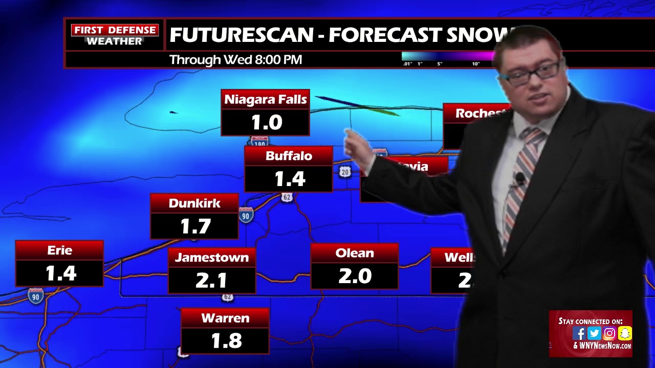
While the exact impacts are still in question as well, here is one computer model solution of overall snowfall totals.

This model is suggesting snow amounts between one and three inches. Some other models are trying to be more aggressive with the snow. The main factor in the snow will be the amount of sleet we mix in. If we can get more sleet mixing in, we will keep the snowfall totals down. If we get less sleet and more snow, the totals will be bumped up
This will be something we will be keeping our eyes on over the next 24 to 48 hours.

High pressure builds in towards the end of the week with a big warmup coming. That means mostly sunny conditions over the weekend and temps back into the 40s across the region.
WNYNewsNow is a proud Ambassador for the NOAA Weather-Ready Nation program.


Leave a Reply