JAMESTOWN – With a heathy southwest wind and a cold air mass moving through, the few patches of open water on Lake Erie has generated some snow of its own this afternoon.
The National Weather Service in Buffalo has issued a Winter Weather Advisory for Lake Effect Snow for Chautauqua and Cattaraugus Counties running through 4 AM Wednesday morning.

Lake snow will become more persistent throughout the afternoon and continue into the morning hours of Wednesday. While the lake is mainly frozen, there are a few patches of open water near Long Point, Ontario Canada on the Niagara Peninsula, those holes in the ice coverage are just enough to get the lake excited and rev up the lake snow machine.
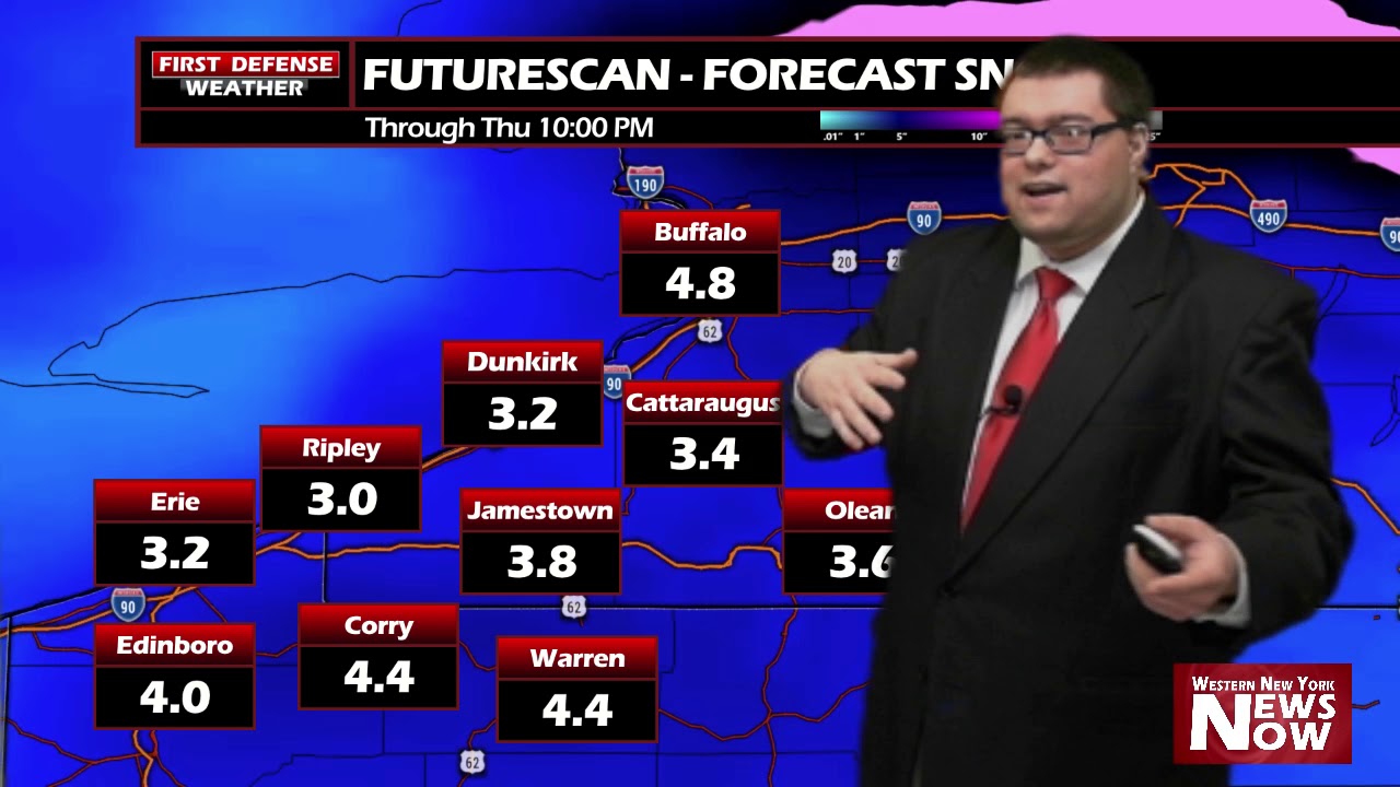
Overall snow totals will be manageable. We’re looking at a range of 2 to 4 inches for most areas but as usual with lake effect, we’ll likely be dealing with some localized totals closer to 5 or 6 inches in spots.

In combination to this, it will remain cold throughout much of the week. We should be close to 40 this time of the year. We will not see anything close to that until the weekend.

The pattern will start to change heading into the weekend allowing much more milder air with a southernly wind aloft to come into Western New York. That will spike temps into the 40s on Saturday and the lower 50s on Sunday. That’s some nice spring weather!
Also, don’t forget. Daylight Saving Time begins at 2 AM Sunday so make sure to turn those clocks head one hour and change the batteries in your NOAA Weather Radio and smoke detectors before you head to bed on Saturday night!

WNYNewsNow is a proud Ambassador for the NOAA Weather-Ready Nation program.


Leave a Reply