JAMESTOWN – A Warm front is pushing through early this afternoon and rising temperatures into the 60s but some rain and storms are on the way to Western New York.
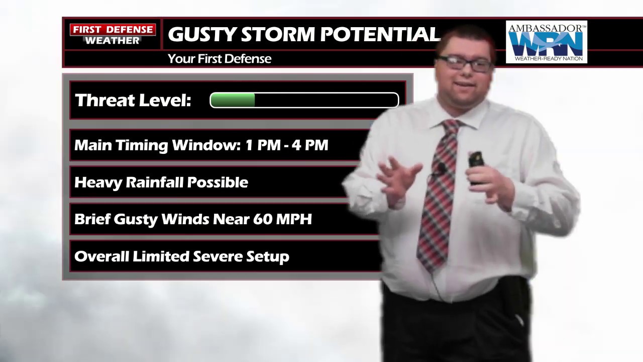
After keeping the Southern Tier out of an organized risk for the past couple of days, as of the 1 PM update, the NOAA Storm Prediction Center has finally placed the region under a less-than-average “Marginal” Risk (1/5) for severe thunderstorms this afternoon.

The overall setup is weak with low instability values but with gusty winds nearing 50 MPH at times through the afternoon, that could be just enough to push a thunderstorm or two to strong or severe levels with damaging winds.

The main timing window for the thunderstorm activity this afternoon will be now until 4 PM. Showers and storms may still linger after 4 PM but by that time, the atmosphere will become a bit more stabilized due to the rain moving through and the loss of daytime heating.

Saturday is the “Pick Day” of the weekend; mostly sunny with temps remaining in the 60s.
We could be going through another round of stronger storms with damaging wind gusts Sunday as the SPC has a Marginal Risk defined for Northwestern Pennsylvania. The risk does not include any part of Western New York at this time but that could change between now and then.

Another Cold front will sweep through on Monday dropping temps throughout the day. We should be near 50 in the morning, sliding through the 40s throughout the afternoon.
Limited rain chances return almost each and every day next week while getting back into the 60s by next Thursday.

Storm Spotter Training: The National Weather Service in Buffalo will be conducting their first ever online training class on Tuesday, May 2 at 7:00 PM. For the online training, you do need to preregister as spots for the online are limited. You can register your spot a http://www.weather.gov/buf/skywarn

Attendees will learn many topics to becoming a trained storm spotter, such as identifying storm structure, basic meteorology relating to severe convection (severe thunderstorms, tornadoes, etc), severe weather safety, and proper reporting techniques.
I encourage everyone to attend a training session; we are in desperate need of more trained spotters. What many people may not know is that spotters actually contribute to the warning process. Remember, Doppler radar looks above the ground; it’s only spotters who see what is happening down at the ground.
WNYNewsNow is a proud Ambassador for the NOAA Weather-Ready Nation program.
![]()


Leave a Reply