JAMESTOWN – The next several days will be unsettled as we bring some more rain back into Western New York throughout the rest of the week.
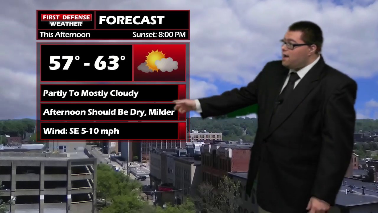
The afternoon today will be dry. Clouds have broken up a bit across the western most portion of the Southern Tier but most of the day will be partly to mostly cloudy.
We will start to bring some scattered rain showers in here tonight with an approaching Warm front. The rain will not be widespread or anything heavy.
The front will spike temperatures well into the 70s for Thursday with the majority of the day dry with partly sunny skies. Some spots well off to the east near the Genesee Valley may end up flirting with 80 as southernly winds drag warmer air into the region.
Like clockwork, you know what lurks behind a Warm front; a Cold front. That front will have widespread rain showers attached to it with an area of Low pressure. Rain will start Thursday evening and continue throughout the night.
Those rain showers will continue into Friday with a few embedded thunderstorms possibly Friday afternoon with temps in the upper 60s.

Easter Weekend: Looking at some of the longer-range model guidance, Saturday will not very good day weather-wise as widespread rain will continue throughout the day. Some models are showing this rainfall to be soaking rain with some areas possibly picking up around an inch of overall accumulation.

Easter Day will be the better of the two weekend days; a few showers will linger into the morning hours on Sunday but clearing out for the afternoon with partly cloudy skies and around average temps in the upper 50s.

Storm Spotter Training: The National Weather Service in Buffalo will be conducting their first ever online training class on Tuesday, May 2 at 7:00 PM. For the online training, you do need to preregister as spots for the online are limited. You can register your spot a http://www.weather.gov/buf/skywarn

Attendees will learn many topics to becoming a trained storm spotter, such as identifying storm structure, basic meteorology relating to severe convection (severe thunderstorms, tornadoes, etc), severe weather safety, and proper reporting techniques.
I encourage everyone to attend a training session; we are in desperate need of more trained spotters. What many people may not know is that spotters actually contribute to the warning process. Remember, Doppler radar looks above the ground; it’s only spotters who see what is happening down at the ground.
WNYNewsNow is a proud Ambassador for the NOAA Weather-Ready Nation program.
![]()


Leave a Reply