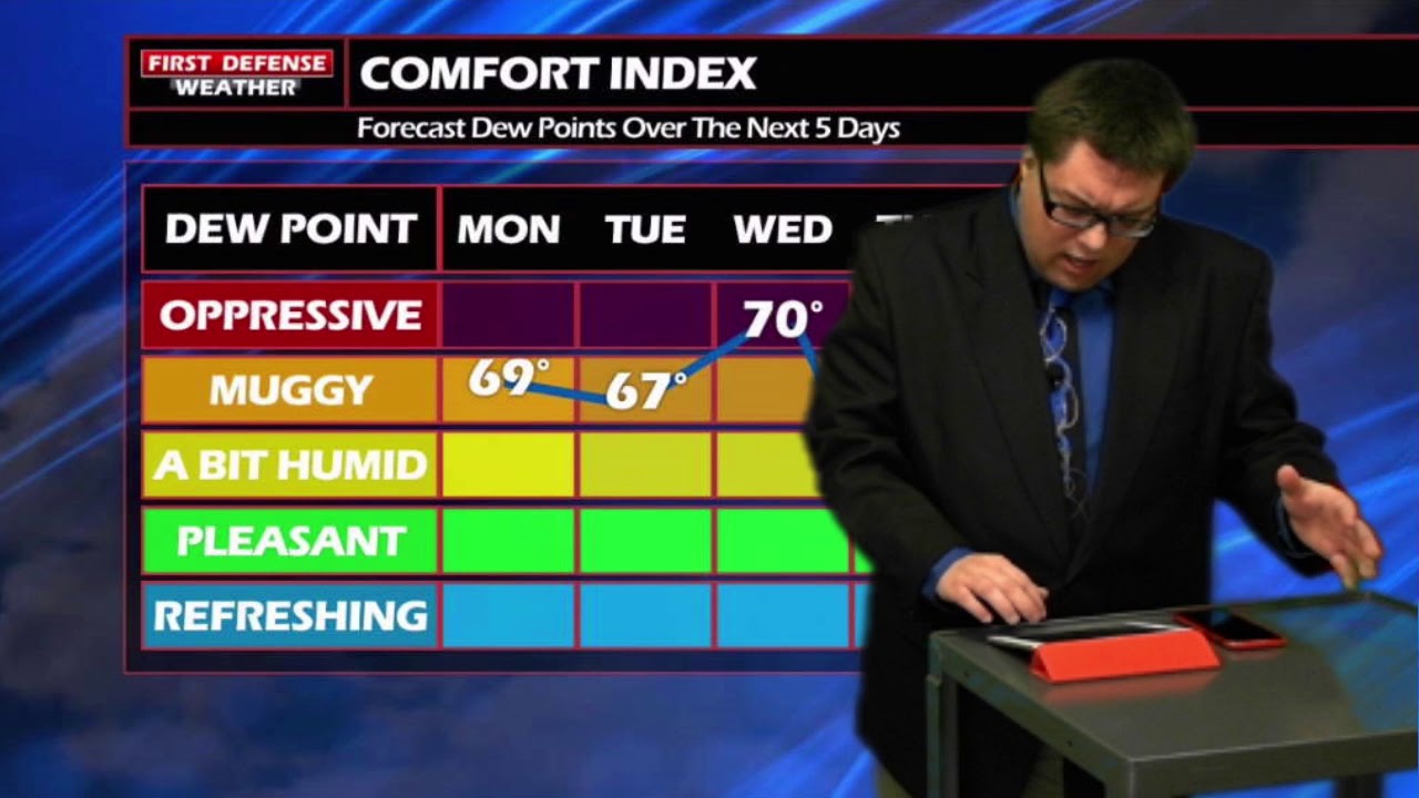
JAMESTOWN – The muggies are here to say through mid week with mostly sunny afternoons. However, a Cold front that will sweep through on Wednesday will be changing point in the overall weather pattern with fall-like temperatures.
Through the afternoon today, expect partly to mostly sunny skies. While the actual highs will range from 74 to 81, it will feel a bit warmer with the humidity in play.
Partly cloudy skies will take us through the overnight with morning lows only dripping back into the lower to mid 60s. With the winds becoming light late, there could be some patchy river valley fog across the Southern Tier and Northwestern Pennsylvania.
Tuesday will be almost a rinse and repeat of today with partly to mostly skies and highs in the upper 70s. A couple computer models are trying to spit up a few isolated showers across the region in the afternoon, due to the high amounts of moisture in the air. While that chance is rather small, about two in ten, we won’t rule that out as a possibility.
A strong Cold front will sweep through the area on Wednesday and will provide the better chance for more widespread showers and storms. Some indications suggest some of this rain could be heavy in nature and could possibly pose a flooding risk.
However, this front will usher in a big change in the weather pattern. After the frontal passage, we will see the humidity values fall down a cliff and the temperatures will fall below-average for Thursday through the weekend.
 Some spots in the valleys and the higher hills may not make it out of the upper 60s on Thursday and Friday. That’s a nice preview of Autumn!

WNYNewsNow is a proud Ambassador for the NOAA Weather-Ready Nation program.


Leave a Reply